The Lyme Corner Trails network traverses three contiguous preserves encompassing 430 acres nestled in the northeast corner of Lyme. Trails allow for passive recreation through the diverse natural habitat of Hartman Park, Walbridge Woodlands, and Philip E. Young Preserve, which create a valuable wildlife corridor in combination with neighboring Beebe Preserve, Nehantic State Forest, and privately owned woodlands protected by deeded conservation easements.
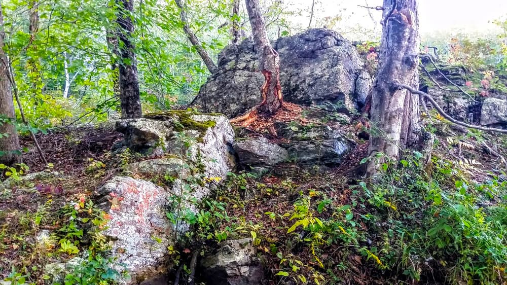
In 302-acre Hartman Park, users can access the Goodwin Trail, an extended trail system crossing four towns (East Haddam, Salem, Lyme and East Lyme). In this park, the Goodwin Trail overlaps with the Red Trail, which starts along the pond and continues past an open field and up onto ridges. Highlights are the “bald nubble” ridgetop of smooth rock that overlooks the valley, and Turtle Rock, a glacial erratic that was plucked from a ledge and transported southward by a glacier thousands of years ago.
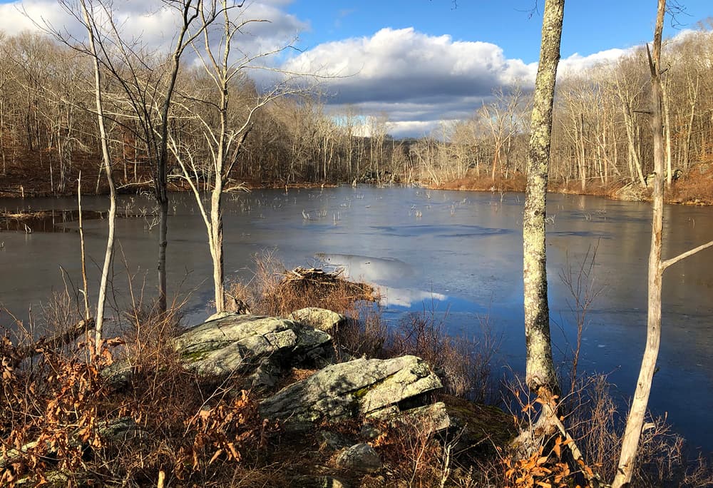
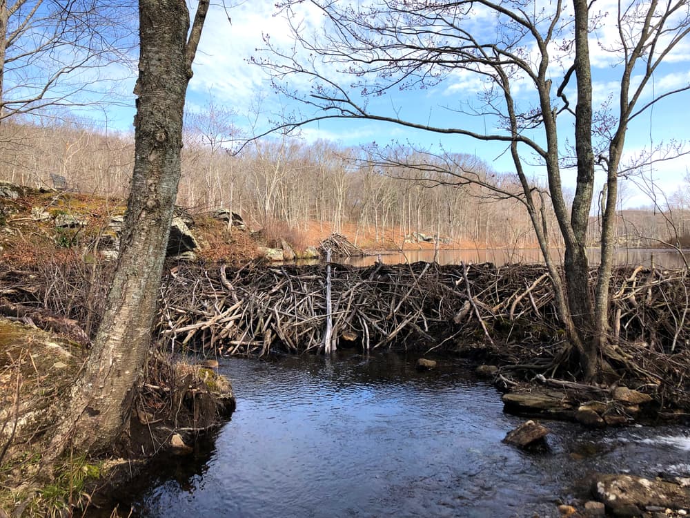
From the Hartman Park Entrance, users can follow Park Road to the orange-blazed Heritage Trail, which is full of artifacts telling the story of the land's agricultural past. To learn more about the artifacts and other natural and cultural trail features, there is a self-guided tour using Heritage Trail Booklet written by Marianne Pfeiffer. The climb to the overlook on Chapman Ridge on the Heritage Trail is steep and rocky - an easier route is to take the Blue Trail and reconnect with the Heritage Trail at the top. From this entrance, there is also a picnic area overlooking a beaver pond at the School Room, and a green-blazed Nature Trail featuring a fairy circle.
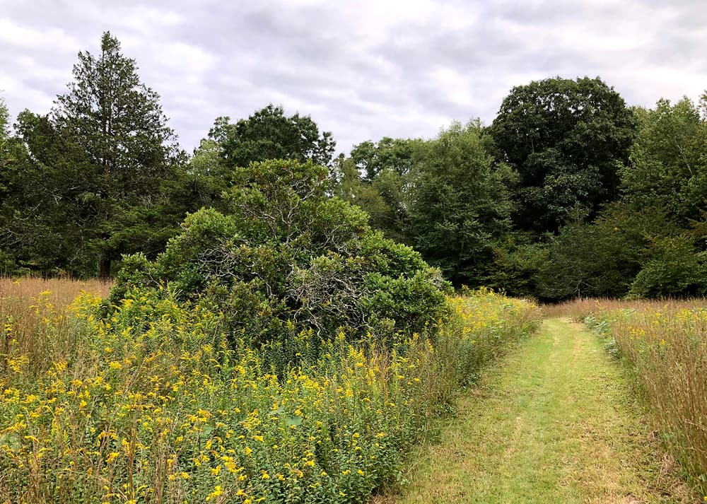
From Field Entrance, a pollinator meadow lies between Yellow Trail connectors and the Red Trail. The Park Road travels throughout the Hartman Park section and is a good landmark to find one's way back to the parking lot from connecting trails. Hartman Park can also be accessed from connecting trails in Nehantic State Forest - East Lyme Block.
Trail users have reported rock scrambles on the Heritage Trail: "Big Scramble" (between Lee Barn and Chapman Farm), and "Little Scramble" (north of Chapman Ridge). A rock scramble is a section of trail with rocks or boulders that often requires the use of both arms and legs, but not rock-climbing gear, to navigate. Earn the Scrambled! rock scramble badge!
From the Hartman Park Entrance, following the Nature Trail to the yellow-blazed Lee Farm Road south to the White Trail will lead to a red cedar grove. Red cedar trees are an indication that this was once pastureland. Recently, deciduous trees that overtopped them were removed to give the cedars access to sunlight, vital for their survival. The grove is mowed every year to maintain the open field. On the edge of the Lee Farm Road near the Cedar Grove is an old stone foundation that may have once been a barn.
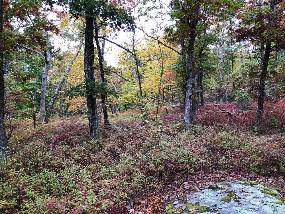
The trails here wind through a variety of habitats with mature oak and hickory forest, mountain laurel, verdant wetlands, and dramatic stone outcroppings. The Blue Trails spurs lead to overlooks with views of Cedar Lake and the surrounding valley.
Before European settlers arrived, this area was a seasonal hunting ground for Indigenous people. After the establishment of the Saybrook colony in 1635, the English set aside this land as a hunting ground for the Nehantic Indians while reserving the right to harvest the valuable timber. During colonial times, subsistence farmers set up homesteads here. Freed African and Native American slaves were welcomed into the area along with the European settlers. In 1800, the census record states that there was a multi-racial community of fifteen households in the area. Indications are that the farmers were able to eke out a living by cooperating with their neighbors—sharing tools, barns, and labor. The destructive agricultural practices of the time damaged the already marginal farmland and most of the inhabitants moved to more fertile lands by the 1850s. Although the land has been undeveloped for more than 100 years and the cleared pastures have been replaced by mature forests, there is still evidence of this once active agricultural community and the Indigenous culture that proceeded it.
Along the Goodwin Trail, and in other areas of Hartman Park, there are many small cairns–piles of stones. Their original purpose is lost, but it is likely they were placed here by Indigenous people many years ago. Mohegans still practice the tradition of memory rock piles to memorialize people, locations or events.
Park Road is the original highway to New London and Colchester from the early settlement in the area. It connects to the Nehantic State Forest’s trail system in East Lyme. The flat rocks that form the Stone Bridge by the beaver pond are typical of old colonial roads.
There are four parking areas for the trail system on Gungy Road.
From CT-82 in Salem, navigate to Darling Road and follow south for 1.2 miles. Turn left onto Gungy Road and follow for 1 mile to Goodwin Trailhead (Hartman Park). For Field Entrance (Hartman Park) trailhead, continue down Gungy Road for 0.3 more miles. For Hartman Park Entrance (Hartman Park & Walbridge Woodlands), continue an additional 0.6 miles south from Field Entrance. Finally, for Young Preserve Entrance, follow Gungy Road south for an additional 0.7 miles. All parking areas and trailheads are on the left.
From US-1 in Old Lyme, follow US-1 North/Boston Post Road for 2.1 miles. Turn left on Grassy Hill Road and follow for 4.6 miles. Continue on Gungy Road and follow for 0.2 miles to Young Preserve Entrance trailhead. For Hartman Park Entrance (Hartman Park & Walbridge Woodlands), continue north on Gungy Road for 0.7 more miles. For Field Entrance (Hartman Park), continue an additional 0.6 miles north from Hartman Park Entrance. Finally, for Goodwin Trailhead (Hartman Park), follow Gungy Road north for an additional 0.3 miles. All parking areas and trailheads are on the right.
Success! A new password has been emailed to you.