Over 1000 miles of trail available to explore, and more added each day!

Avery Preserve

Enjoy a scenic walk through stream crossings and ponds on diverse routes. 
Trail Activity
Hiking Walking
Length
2.60 miles, Network
Difficulty
Moderate
Town
Ledyard
Surface
Packed Earth/Dirt
Pets
Permitted on leash
Fees
No

Description

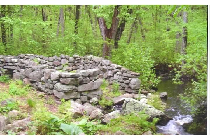
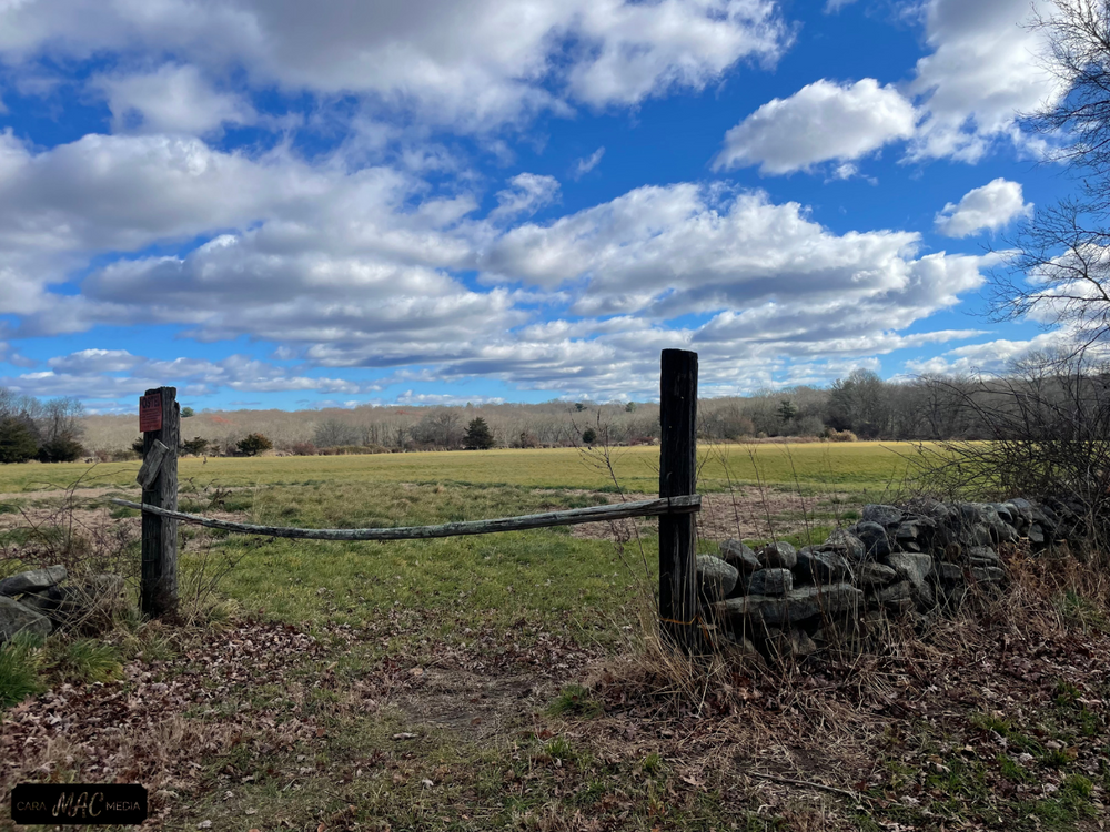
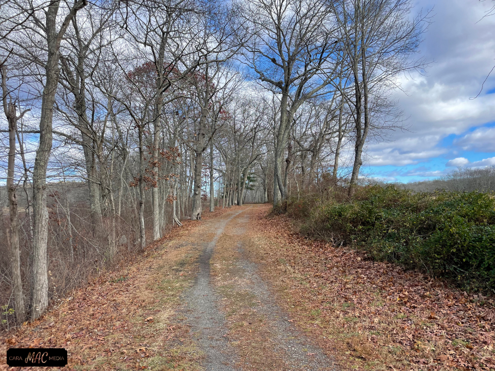
Avery Preserve encompasses an East Tract and West Tract. Avery Preserve West Tract has a network of interconnected trails that are well marked with orange, white, and yellow trail markers. There is plenty of parking in the lot located on the east side of Avery Hill Road (Avery Preserve–East Tract). Crossing Avery Hill Road leads to the trailhead, starting you on the Orange Trail. The Orange Trail borders the preserve and follows along stonewalls of various ages, creating a truly scenic hike. Throughout the Orange Trail are side paths that cross into the central portion of the preserve. These are marked with either yellow or white trail markers. These connections allow for diverse routes while exploring all of the natural beauty of the preserve.  The packed earth and dirt trails range from as narrow as 2-3 feet to wide open, with some stream crossings and vernal ponds along the way. Total trail distance is approximately 2.56 miles with 270 feet of elevation changes. Combining the hills with the occasional exposed rocks and roots creates a moderately challenging hike.  It is common to see various types of birds and land animals. Also of note, the Billings Avery Brook is located on the southern portion of the preserve.

Other Information

Please adhere to the following guidelines when visiting the preserve:

  • Avery Preserve is open to foot traffic only.
  • Dogs must be leashed at all times.
  • The preserve is open dawn to dusk.
  • Please stay on the marked trails.

This property is part of Avalonia's Hike & Seek Program scavenger hunt program, start your adventure here

  • West Tract, 76.59 acres (1970). Open upland woods, Billings-Avery Brook and glacial boulder deposits.
  • East Tract, 22.48 acres (1977). Maple swamp and upland woodlands, giant rhododendron, Atlantic white cedar, orchid species.
  • Sheep Wash Tract, 0.49 acres (1995). Historic dry-wall sheep wash, south of Billings-Avery Brook.
  • Town of Ledyard Transfer, 0.53 acres (2014). Addition to the west tract.

Trail Manager

Avalonia Land Conservancy preserves natural habitats in southeastern Connecticut by acquiring and protecting lands, and communicating the value of these irreplaceable resources. Learn more on their website or contact info@avalonialc.org.

Avalonia Land Conservancy
P.O. Box 49
Old Mystic, CT 06372
(860) 884-3500
View website

Trail Tips

Volunteer
Learn more about the trail organization that manages your favorite trail.
Legend
Hide All

Trailhead Information

The trailed portion of the preserve is within the West Tract of Avery Hill Road, 0.75 miles north of Route 214. Parking lot on East tract. 

From the west: Off of CT-12 S talk a right onto CT-214E. Take a left onto Avery Hill Rd. and the parking lot will be on your right. 

From the east and south: Follow CT-2 W and CT-214 W to Avery Hill Rd in Ledyard. Take a right onto Avery Hill Road, the parking lot will be on your right. 


Click on a parking icon to get custom directions
Please Log In or Create Account to add comments.
jnammirati
August 05, 2023
This was a fine, quick hike, but the mosquitoes were swarming. Not biting, but swarming around our ears to a maddening degree. This was despite being covered in Off.

Also, the little off shoot trail to Mill Pond Damn was a little confusing. We followed it expecting to find a damned pond and the end of the trail but the path continued and there was no clear pond. We didn’t realize that by following the trail we left the preserve entirely and couldn’t find our way back without backtracking. It wasn’t a problem and once we returned we saw the sign saying we were now entering the preserve but it was briefly a bit confusing.
SHARE THIS TRAIL
PRINT THIS TRAIL

Add Trail Log

Please wait…
Join In on the Fun!
Log in or create an account below to unlock all the great features of Connecticut Trail Finder: keep track of trails you want to do, preserve memories of trails you’ve done, and more!
Your log in attempt was not successful. Please try again.
    Lost your password? Reset your password
    Don't yet have an account?
    There was an issue with your submission. Please try again.
      * Indicates required field
      Already have an account? Login here
      Enter your username, and we will send you a new, randomly generated password to your email account.
      There was an issue with your submission. Please try again.

        Success! A new password has been emailed to you.

        Log in now

        Please wait…