Ready, Set, Go Outdoors! Connecticut Trails Day is June 6 & 7. Explore 200+ FREE outdoor adventures!
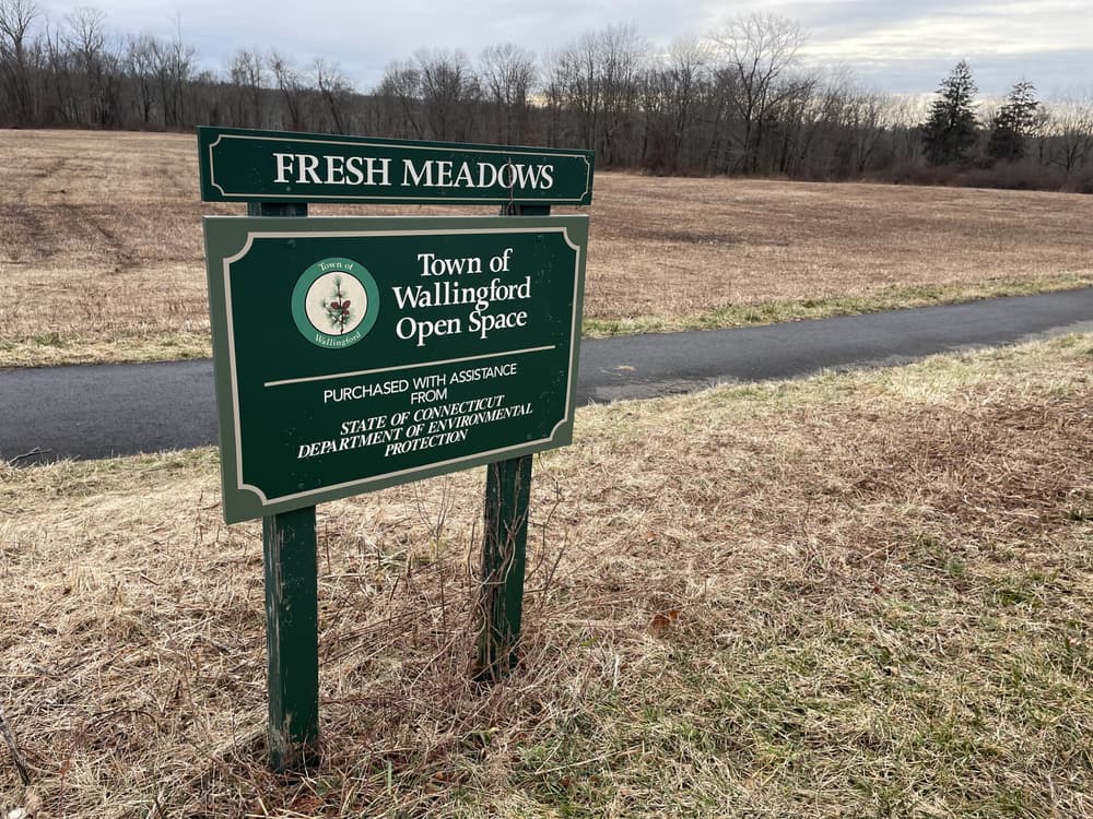
Between pond, woodland, wetlands and meadows, this open space offers a multitude of habitats and wildlife, easily accessible for families with strollers and for people with walking aids.
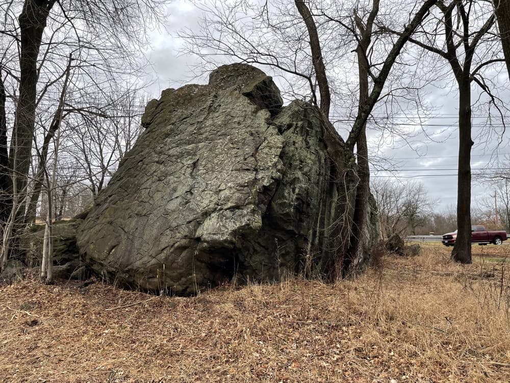
From the paved southern parking lot, a paved multi-use trail runs parallel to Cheshire Road. A giant boulder, one of the largest glacial erratics in CT, is situated between the trail and the street. This side also features an accessible port-a-potty and multiple memorial benches. This trail offers views over the Fresh Meadow open space with woods and wetlands that are excellent habitat for birds and wildlife. There is an additional small gravel parking lot at the end of the paved trail.
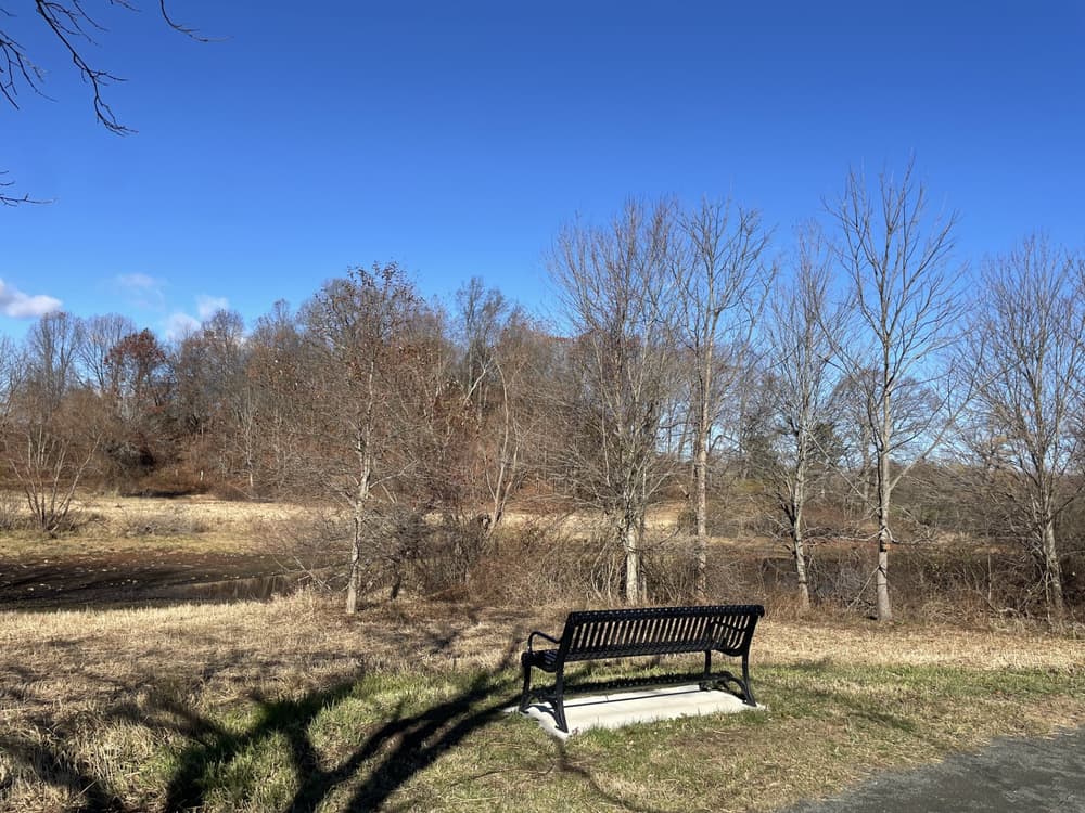
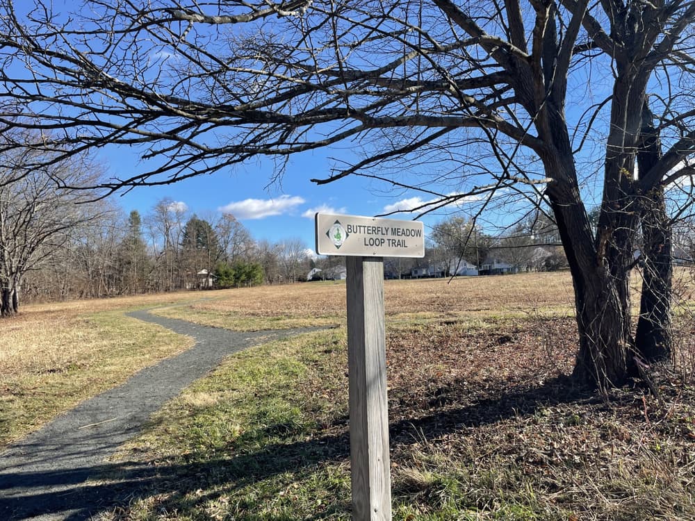
From the gravel parking lot on the other side, the Butterfly Meadow Loop Trail offers an accessible stone dust trail towards the pond and a smaller meadow. A short spur turns left to a bench on the banks of Peanut Pond, a great opportunity to observe egrets and other wildlife. The pond ias also know as Ice Pond as it was formerly used to cut ice blocks, or Galko Pond after the family who farmed the land. The main trail continues over a small bridge to the butterfly meadow. Hikers can exit to sidewalks on Cheshire and Schoolhouse Roads or continue the loop back to the parking lot. The Butterfly Meadow Loop Trail is listed on the CT Pollinator Pathway inventory.
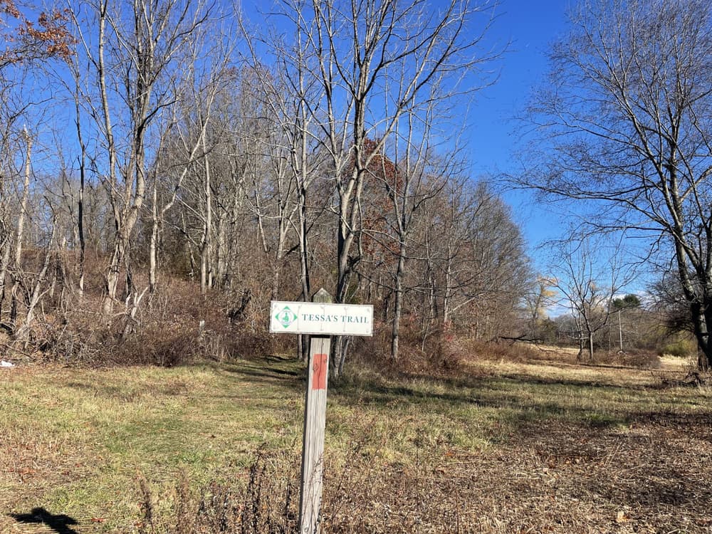
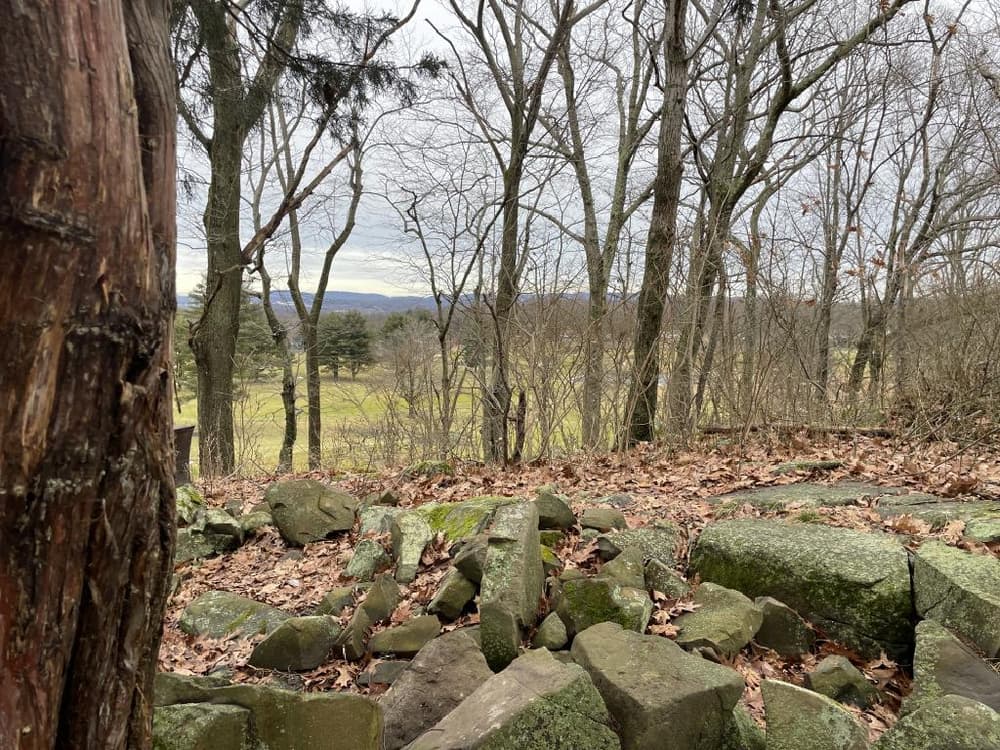
Also from the gravel parking lot, Tessa's Trail offers a more challenging experience. A red-blazed hiking trail winds up and around a small hill and past an old apple orchard. From the top, there is a seasonal view across the golf course and parts of Yalesville and Wallingford, and towards Powder Ridge.
The Cheshire Road Trail, the Butterfly Meadow Loop Trail and the pond spur were installed under a Connecticut Recreational Trails Program Grant by the CT Department of Energy and Environmental Protection.
The Butterfly Meadow Loop Trail can also be accessed via a sidewalk ramp at the Cheshire Rd - Schoolhouse Rd intersection.
From Route 15, take Exit 64 and turn west onto Quinnipiac Avenue/South Turnpike. Turn right on Cheshire Road. At the top of the hill, turn left to continue on Cheshire Road, then turn right to continue on Cheshire Road The parking lots are on both sides of Cheshire Road.
From I-91 South, take Exit 15 and turn left (west) on Route 68. After crossing under Route 15 and over the Quinnipiac River, turn left onto Route 150 (Main Street) for 1.3 miles. Turn right onto Parker Farms Road. At the 4-way intersection, turn left to stay on Parker Farms Road. Continue on Parker Farms Road past the golf course, then turn right onto Cheshire Road. Take another right to stay on Cheshire Road. The parking lots are on both sides of Cheshire Road just past this intersection.
From I-91 North, take Exit 13 to Wharton Brook Connector. Take a left at the dead end on Route 5 and then a quick right onto Toelles Road. Pass under Route 15 and turn right onto South Turnpike Road and continue for 1.7 miles. Take a left onto Cheshire Road. Turn right to stay on Cheshire Road and the parking lots on are both sides of Cheshire Road.
From Cheshire, take Wallingford Road east past Gaylord Hospital. Then turn right onto Cheshire Road OR take Cook Hill Road east for 2.5 miles and turn left onto Schoolhouse Road. Head west onto Cheshire Road and the parking areas are on both sides of the Road.
Success! A new password has been emailed to you.