New Feature:Now earn badges with a free CT Trail Finder account!

Hatchery Brook Conservation Area and Bicentennial Park

Hatchery Brook Conservation Area and Bicentennial Park together contain Berlin’s most diverse trail system, including parts of the Metacomet Loop Trail.
Trail Activity
Hiking
Length
8.9 miles, Network
Difficulty
Easy, Moderate
Town
Berlin
Surface
Packed Earth/Dirt, Grass, Boardwalk, Paved/Cement
Pets
Permitted on leash
Fees
No

Description

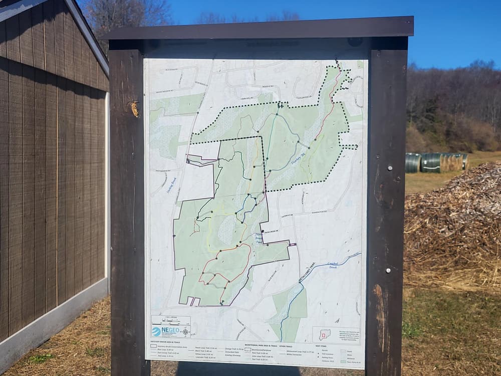
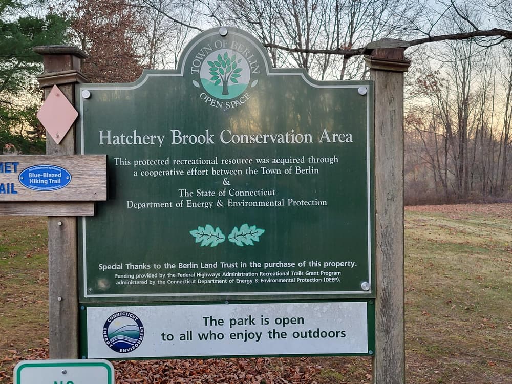
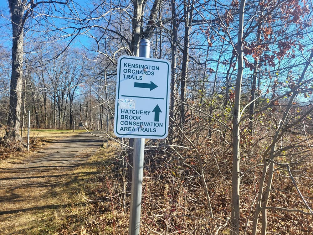
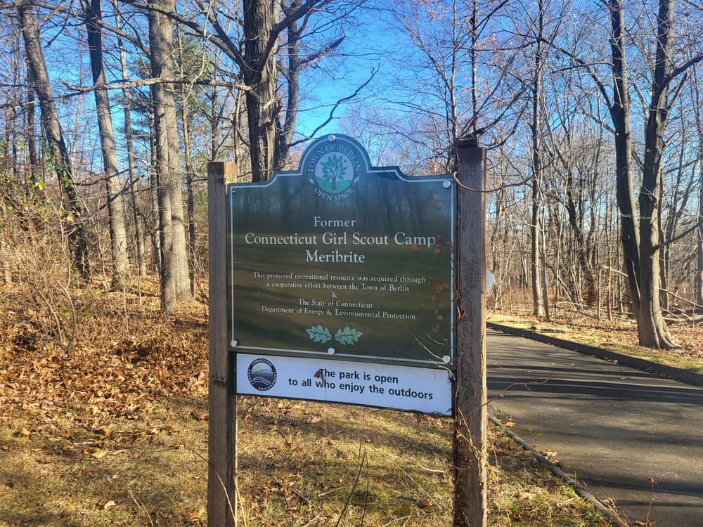
The 188-acre Bicentennial Park is contiguous to the Town’s 300-acre Hatchery Brook Conservation Area. Trails pass through habitats including wooded areas, open fields, old orchards, and wetland areas along Hatchery Brook, as well as through the Connecticut Girl Scouts’ former Camp Merebrite.

Multiple smaller loops can be hiked individually or combined to a longer distance.

  • From Norton Road in the north, the Pink Trail connects to the Teal and Lime loops in Bicentennial Park.
  • From the south, the Red Loop leads to the Yellow Loop which connects to the Blue Loop, Black and Dark Green Connectors, and the Metacomet Loop Trail.
  • From the east, the Peach Loop branches off the Metacomet Trail at Kensington Road.

The Metacomet Loop Trail ties the two areas and most of the trails together. It was completed in 2018 and is maintained by the Connecticut Forest and Park Association. Coming from Timberlin Park, the Blue/Red Rectangle blazed Metacomet Loop Trail goes through Bicentennial Park and Hatchery Brook Conservation Area for about 2.5 miles and reconnects to the Metacomet Trail at the intersection of Orchard Road and Kensington Road. The full loop, following the Metacomet Trail south along the eastern Hanging Hills and through Hubbard Park in Meriden, then along Edgewood Road back to Timberlin Park, comprises about 12.5 miles.


Other Information

In 2019 an Eagle Scout constructed the pink trail to connect to Norton Road, including a new bridge across Hatchery Brook. Another volunteer completed a tree identification trail identifying 38 species of native trees present in the Park. The Hatchery Brook entrance on Orchard Road also features the Berlin Community Gardens.

Trail Manager

Town of Berlin, Parks & Recreation
240 Kensington Road,
Berlin, CT 06037

(860) 828-7009
View website

Trail Tips

Plan Ahead and Prepare
Know how to choose and use your gear for each trip, factoring in the terrain and conditions.
Legend
Hide All

Trailhead Information

From points northwest

Head east on Route 72. Take Exit 2 for Corbin Avenue/Route 372 and head south. Stay right to continue on Corbin Avenue, High Road, and eventually Chamberlain Highway/Route 71A. Where Route 71A becomes Route 71, either turn left for Norton Road and do one of the following

    • turn right on onto Winesap Road and park in the cul-de-sac (observe all no parking signs, parking is permitted only in the cul-de-sac) to access the Teal Loop and Metacoment Loop Trail OR
    • continue to Castlewood Drive and park along the road (walk east to to access the Pink Trail which begins at 402 Norton Road just before Hatchery Brook)

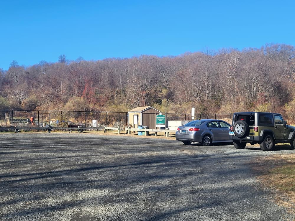
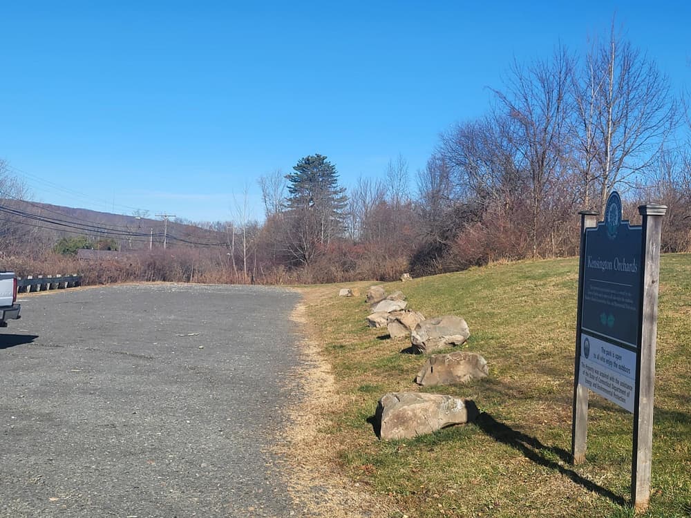
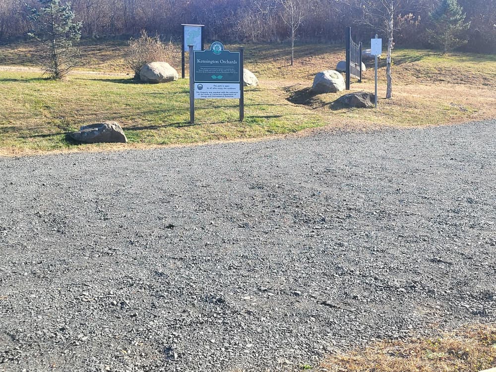
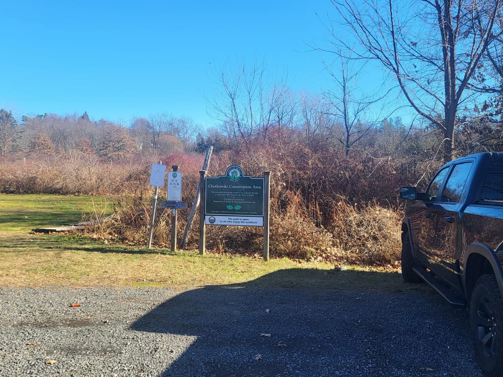
OR continue straight for Chamberlain Highway and park on the west side of the park at the Chotkowski Conservation Area parking lot or further at the Kensington Orchards Parking lot. 

From Route 9 and points northeast

From Route 9, take Exit 32. From the south, turn right onto Worthington Ridge. From the north, turn right onto Frontage Road and right again onto Worthington Ridge. Head south on Worthington Ridge for about 0.5 miles, then turn right onto Hudson Street, which will become Norton Road. After crossing the rail road tracks, either turn left for Kensington Road

    • parking for 2 cars between #1696 and #1670 Kensington Road, OR
    • where Kensington Road takes a 90-degree bend, take Gateway Road, then a left onto Cross Creek Drive and park in the cul-de-sac

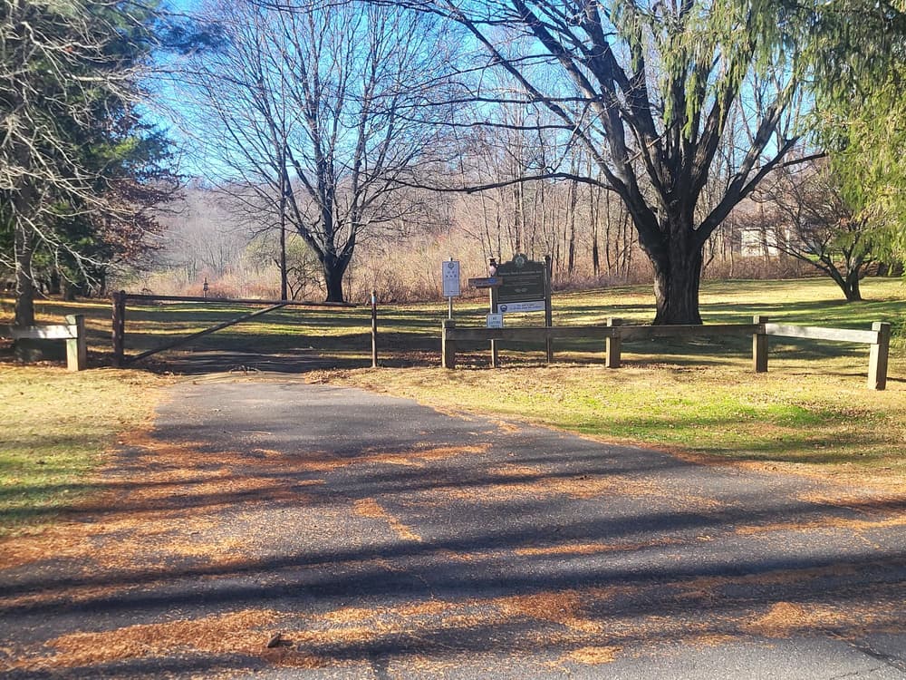
OR continue straight on Norton Road with access points from Castlewood Drive (walk east to to access the Pink Trail which begins at 402 Norton Road just before Hatchery Brook), or at the end of Winesap Road (see above).

From I-691 and points south

From I-691 eastbound, take Exit 3 and turn left onto Chamberlain Highway/Route 71 north. From I-691 westbound, take Exit 3 and turn left onto Lewis Avenue. Turn left again onto Kensington Avenue and then turn right onto Chamberlain Highway/Route 71. Head north. After about 3 miles, either

    • turn right for Orchard Road and continue for about 0.4 miles to the parking lot and access to the Community Gardens, Hatchery Brook, and the Red Loop OR
    • continue straight on Chamberlain Highway. Park at the Kensington Orchards Parking lot (follow the partially paved driveway to the trailhead) or further north at the Chotkowski Conservation Area parking lot with access to Metacomet Loop and Black Trail.
Click on a parking icon to get custom directions
Please Log In or Create Account to add comments.
Add a Service
Find businesses and organizations that are located around this trail that support adventuring outdoors!
Legend
Hide All
Hide All
No services shown. Try zooming out.
Hang Tight!
Nearby services are loading
SHARE THIS TRAIL
PRINT THIS TRAIL

Add Trail Log

Please wait…
Join In on the Fun!
Log in or create an account below to unlock all the great features of Connecticut Trail Finder: keep track of trails you want to do, preserve memories of trails you’ve done, and more!
Your log in attempt was not successful. Please try again.
    Lost your password? Reset your password
    Don't yet have an account?
    There was an issue with your submission. Please try again.
      * Indicates required field
      Already have an account? Login here
      Enter your username, and we will send you a new, randomly generated password to your email account.
      There was an issue with your submission. Please try again.

        Success! A new password has been emailed to you.

        Log in now

        Please wait…