Over 2500 miles of trails on CT Trail Finder, with more on the way!

Roaring Brook Falls

The Roaring Brook trail provides a short, moderate to strenuous hike to the second tallest waterfall in Connecticut, with the option to extend the hike onto the Quinnipiac Trail.
Trail Activity
Hiking
Length
0.9 miles, One Way
Difficulty
Moderate, Strenuous
Town
Cheshire
Surface
Packed Earth/Dirt
Pets
Permitted on leash
Fees
No

Description

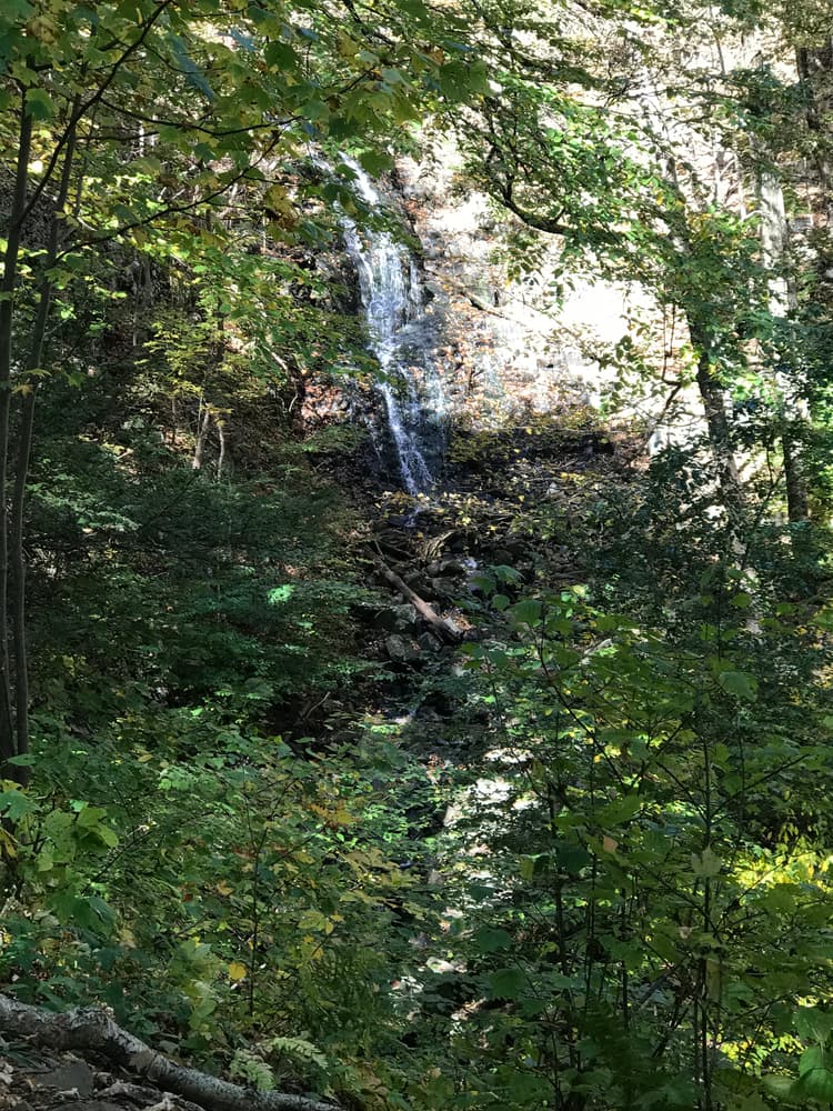
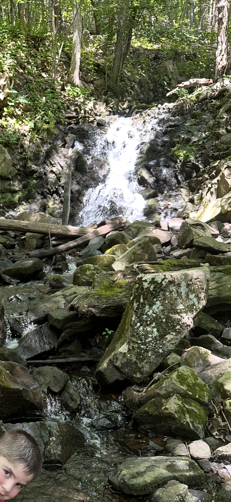
Roaring Brook contains nature trails, a diversity of habitats, wildflowers, and an 80-foot waterfall, the tallest single-drop waterfall and second-tallest overall in Connecticut! The trails are open year-round.

The Orange Trail follows Roaring Brook from the trailhead and joins the Quinnipiac Blue Trail, managed by Connecticut Forest and Park Association. The waterfall can be seen from an observation point on the orange trail. Some trail sections are rocky and steep.

Other views from the trail include forest, pond, a picnic area, tennis courts (for residents only), and chimney remnants.

Other Information

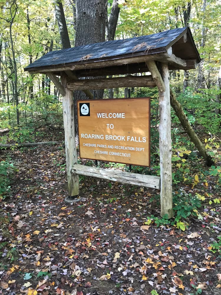
Property information is available at the trailhead kiosk.

Rules and regulations

  • Please remain on the trail - walking off the established trail may lead to erosion and habitat destruction.
  • Please respect this open space property by keeping the area clear of trash.
  • Please leave plants and animals undisturbed.
  • Dogs are welcome on-leash.

Trail Manager

Town of Cheshire, Department of Recreation
203-272-2743
View website

Trail Tips

Respect Wildlife
Avoid known animal mating or nesting areas during sensitive times.
Legend
Hide All

Trailhead Information

The main trailhead is at the end of Roaring Brook Road, with on-street parking at the end of the road.

From I-84:

Take Exit 26 and turn east onto Route 70/Waterbury Road toward Cheshire. Travel approximately 2.6 miles, then turn right onto Mountain Road. Follow for 2.4 miles. Turn right onto Roaring Brook Road. Trailhead is at the end of Roaring Brook Road.

From points east and west: 

Take Route 68 to Cheshire Town Center and turn south onto Route 10/South Main Street. Past Cheshire High School, take the second right and follow Higgins Road to the end, then turn left onto Mountain Road. Take the first right for Roaring Brook Road, trailhead is at the end of the road.

From points south and north:

Take Route 10 towards Cheshire. Just south of Cheshire High School/Bartlem Recreation Area, turn west onto Higgins Road and follow to the end, then turn left onto Mountain Road. Take the first right for Roaring Brook Road, trailhead is at the end of the road.

Click on a parking icon to get custom directions
Please Log In or Create Account to add comments.
Add a Service
Find businesses and organizations that are located around this trail that support adventuring outdoors!
Legend
Hide All
Hide All
No services shown. Try zooming out.
Hang Tight!
Nearby services are loading
SHARE THIS TRAIL
PRINT THIS TRAIL

Add Trail Log

Please wait…
Join In on the Fun!
Log in or create an account below to unlock all the great features of Connecticut Trail Finder: keep track of trails you want to do, preserve memories of trails you’ve done, and more!
Your log in attempt was not successful. Please try again.
    Lost your password? Reset your password
    Don't yet have an account?
    There was an issue with your submission. Please try again.
      * Indicates required field
      Already have an account? Login here
      Enter your username, and we will send you a new, randomly generated password to your email account.
      There was an issue with your submission. Please try again.

        Success! A new password has been emailed to you.

        Log in now

        Please wait…