Ready, Set, Go Outdoors! Connecticut Trails Day is June 6 & 7. Explore 200+ FREE outdoor adventures!
Steep Rock Preserve is the largest of four preserves managed for public outdoor recreation by the land trust organization Steep Rock Association. There are several loop trails that explore natural features such as the Shepaug River Valley landscape view from the Clamshell Loop Trail (Orange Square) or the 776-foot Steep Rock Summit which is part of the Steep Rock Loop Trail (Yellow Circle).
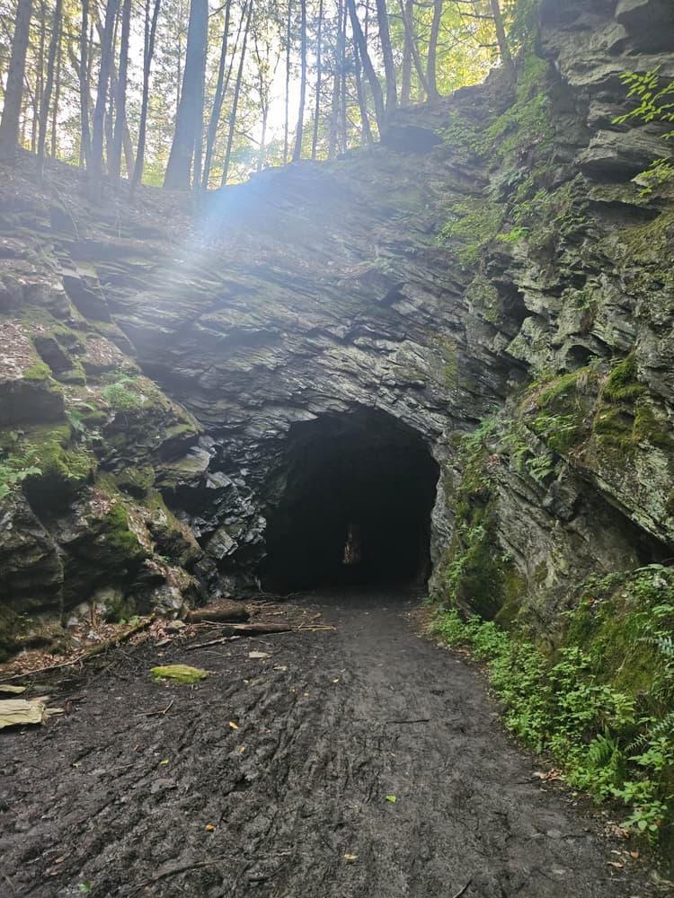
Steep Rock Preserve contains historic cultural features such as the Holiday House ruins on the Holiday House Loop Trail (Blue Circle) and the hand-dug railroad tunnel on the Pinney Loop (Blue Square) Trail. The chiseled bedrock tunnel can be accessed with a 3.6-mile round trip out-and-back route. Start at the main parking lot and head down the unpaved road section of the yellow-blazed Steep Rock Centennial Loop. Then turn onto the Pinney Loop (Blue Square) which leads directly to the tunnel. The tunnel's cool, damp air is especially welcoming in summer heat.
The trails offer opportunities to view a multitude of flora and fauna, including turtles, snakes, large mammals such as black bears, coyotes, bobcats, fishers, and river otters, diverse waterfowl, old growth hemlock, and floodplain forest. Many trails provide access to the Shepaug River for fishing, paddling, picnicking, and/or riverside camping by reservation. There is also a riding ring near the main parking area. For more information about fishing, paddling, and camping at Steep Rock Preserve, visit the Steep Rock Association website.
In 1889, architect Ehrick Rossiter purchased 186 acres of forested land in view of the country house he was building in order to preserve it from clearcutting. Locals were welcome to recreate on the carriage roads and river crossings he built there. He then donated the land to a group of trustees in 1925 to ensure its preservation would continue, and this group later expanded the preserve by 100 more acres (the area known as the Clam Shell) to preserve the view from Steep Rock Summit. In 1961, Steep Rock Association was formally established as a land trust and Steep Rock Preserve continued to grow to its present size at 998 acres.
From 1871 to 1872, over the course of only nine months, Pennsylvania coal miners constructed the 235-foot-tall railroad tunnel through Steep Rock Ridge for the Shepaug Valley Railroad using hand picks, dynamite, and nitroglycerin. This railroad ceased operation in 1948.
Rossiter was commissioned by wool importer Edward Van Ingen in 1892 to design and build the first grand summer hotel in Washington, overlooking the Shepaug River. Van Ingen wanted the hotel to stand as a memorial to his daughter after she died of Scarlet Fever. Construction was complete in 1893, and it was primarily a vacation retreat for working class women from New York City.
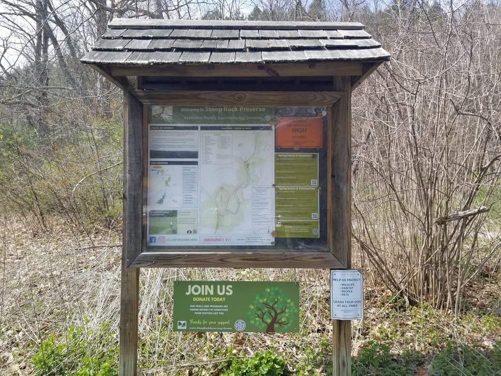
The preserve is open daily from sunrise to sunset.
Please adhere to the following regulations when visiting.
In winter:
Mountain bikers:
Parking is available on Tunnel Road in dirt parking lots both west and east of the on-site bridge over the Shepaug River. An overflow parking area is located an additional 0.2 miles south on Tunnel Road.
Take Exit 17 in Waterbury for CT-64 toward CT-63/Middlebury/Watertown. Continue on CT-64 for 7.6 miles. In Woodbury, turn right onto US-6 East/Main Street South. Follow for 1.7 miles. Turn left onto CT-47 North/Washington Road. Continue on CT-47 North for 7/8 miles. Then, in Washington Depot, turn left onto Main Street #1/River Road and follow for 1.4 miles. Finally, turn left onto Tunnel Road. Park in one of the three parking areas on Tunnel Road.
Take Exit 7 in Danbury for US-7 East toward US-202/Brookfield/New Milford. Continue on US-202 East/US-7 North for 6.1 miles. Continue on US-202 East for another 7.7 miles. Turn right onto CT-109 East and follow for 6.1 miles. Then, in Washington Depot, turn left onto Main Street #1/River Road and follow for 1.4 miles. Finally, turn right onto Tunnel Road. Park in one of the three parking areas on Tunnel Road.
Success! A new password has been emailed to you.