New Feature:Now earn badges with a free CT Trail Finder account!

Tefftweald at Birchenturn

Tefftweald at Birchenturn, located in North Stonington, offers trails through dense wood, rock ledges, open woodlands and an upland forest with views of an old well, stone walls, Wyassup Brook, and Lily's Lea meadow.
Trail Activity
Hiking
Length
2.1 miles, Network
Difficulty
Moderate
Town
North Stonington
Surface
Packed Earth/Dirt, Rock/Ledge, Grass
Pets
Not Permitted
Fees
No

Description

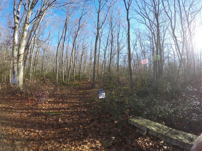
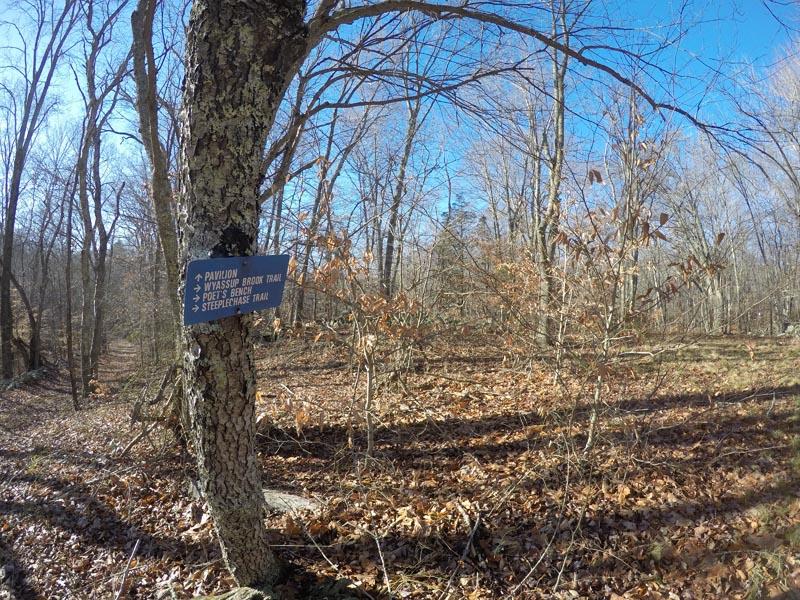
This preserve hosts a network of trails that are independently named but all connected.  This allows for a diverse hiking experience through dense woods, along rock ledges, up rocky knolls, and/or through grass/meadow.  The trails are well marked with blue arrows, signs, and maps to help guide you through your adventure.  A portion of the trail is unmarked (an old portion of the trail), creating a sense of adventure even though it is clearly marked on the maps. 

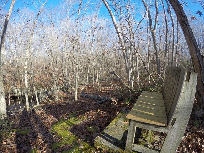
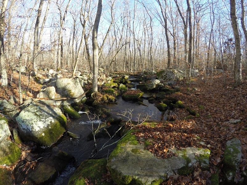
There are several short loops trails on this preserve with 1.5 miles of main trail. Totaling 2.1 miles of trails with elevation changes of 220 feet, this preserve offers a moderately challenging hike with varying trail widths of 2 feet to wide open. Along the trails are stone walls, old housing structures, an old well/water pump, and a strongly flowing Wyassup Brook that leads to more wetlands. Along the Wyassup Brook and atop a small knoll sits Poet’s Bench. It is not uncommon to see whitetail deer, squirrels, and birds (including waterfowl) here.

Other Information

Rules

  • No dogs are allowed on this preserve. 
  • No fires.
  • Carry out what you carry in. 

This property is part of Avalonia's Hike and Seek Program scavenger hunt program!

Trail Manager

Avalonia Land Conservancy
P.O. Box 49
Old Mystic, CT 06372
(860) 884-3500
View website

Trail Tips

Respect Wildlife
Avoid known animal mating or nesting areas during sensitive times.
Legend
Hide All

Trailhead Information

Trail Access

The trail is located at 280 Grindstone Hill Road. Access through driveway at 282 Grindstone Hill Road on crest of hill approximately 0.8 miles west of Route 49. Park in the designated area along lane.

From I-95 North

Drive on I-95 North and take Exit 92 for CT-2 towards CT-49/North Stonington/Pawcatuck. Take Hangmam Road to Grindstone Hill Road in North Stonington.

Click on a parking icon to get custom directions
Please Log In or Create Account to add comments.
Add a Service
Find businesses and organizations that are located around this trail that support adventuring outdoors!
Legend
Hide All
Hide All
No services shown. Try zooming out.
Hang Tight!
Nearby services are loading
SHARE THIS TRAIL
PRINT THIS TRAIL

Add Trail Log

Please wait…
Join In on the Fun!
Log in or create an account below to unlock all the great features of Connecticut Trail Finder: keep track of trails you want to do, preserve memories of trails you’ve done, and more!
Your log in attempt was not successful. Please try again.
    Lost your password? Reset your password
    Don't yet have an account?
    There was an issue with your submission. Please try again.
      * Indicates required field
      Already have an account? Login here
      Enter your username, and we will send you a new, randomly generated password to your email account.
      There was an issue with your submission. Please try again.

        Success! A new password has been emailed to you.

        Log in now

        Please wait…