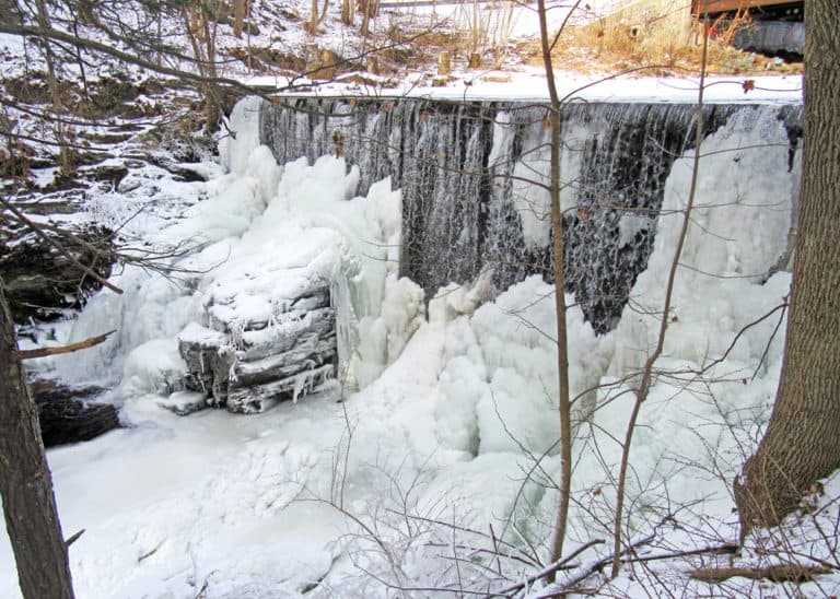
Talcott Ravine Trail passes through a scenic and historic ravine, with highlights such as glacial geologic features, the Tankerhoosen River, the Dobsonville dam, mill ruins, and flora including Umbrella Magnolia.
Talcott Ravine Trail can be accessed on the other side of the gate from the parking area. Beyond the gate, the trail continues past the pond and follows the Tankerhoosen River. It crosses a wooden bridge, then turns north and forks. Hikers can follow the spur trail to the right to continue along the river to a large rock outcrop and a partial view of the dam. To continue on Talcott Ravine Trail, hikers can head back to the intersection and take a right, or skip the spur altogether and continue straight.
In a short while the trail joins the sidewalk on Dobson Road and goes right. It then crosses the dam and continues to an intersection with the Hop River State Park Trail. Users can turn around and follow the Talcott Ravine Trail back to the start for an out-and-back hike, or turn right on the Hop River State Park Trail to make a loop. The loop is completed by turning right either on the Hop River Trail Connector along the pond, or on Elm Hill Road (there is no shoulder on the road so users should take caution). Both right turns will connect hikers back to Main Street, and taking a right will lead back to the cul-de-sac parking area.
Along the Hop River State Park Trail section near the ravine, the “Eastern Highlands” can be seen, consisting of metamorphic rocks similar to granite. This section contains Glastonbury Gneiss and a visible fault line.
The Talcott Ravine was the site of a cotton mill built by Peter Dobson in 1811. Several other mills operated in this rea until 1939. The 26-acre area on which the trail lies was donated to Northern Connecticut Land Trust in 2010 by the Talcott Family.
Follow Hartford Turnpike to Main Street. Turn east onto Main Street. In half a mile, parking is at the end of the cul-de-sac.
Follow Tunnel Road to its intersection with Valley Falls Road and Warren Avenue, near the tunnel. Turn onto Warren Avenue. Follow for 0.9 miles and take a left on Phoenix Street. In 0.8 miles, turn right onto Taylor Street, then right onto Elm Hill Road. Follow for 0.8 miles and turn right onto Main Street. In 0.2 miles, parking is at the end of the cul-de-sac.

Success! A new password has been emailed to you.