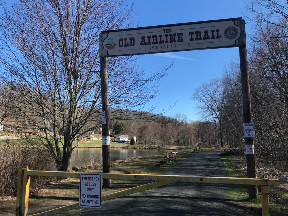
The Air Line State Park Trail exists in two sections. The South section is from East Hampton to Windham and the North section is from Windham to Pomfret with the Thompson addition beyond.
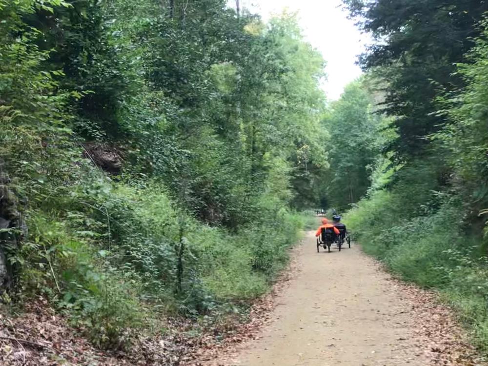
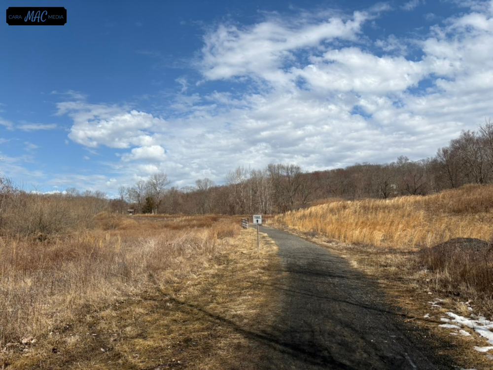
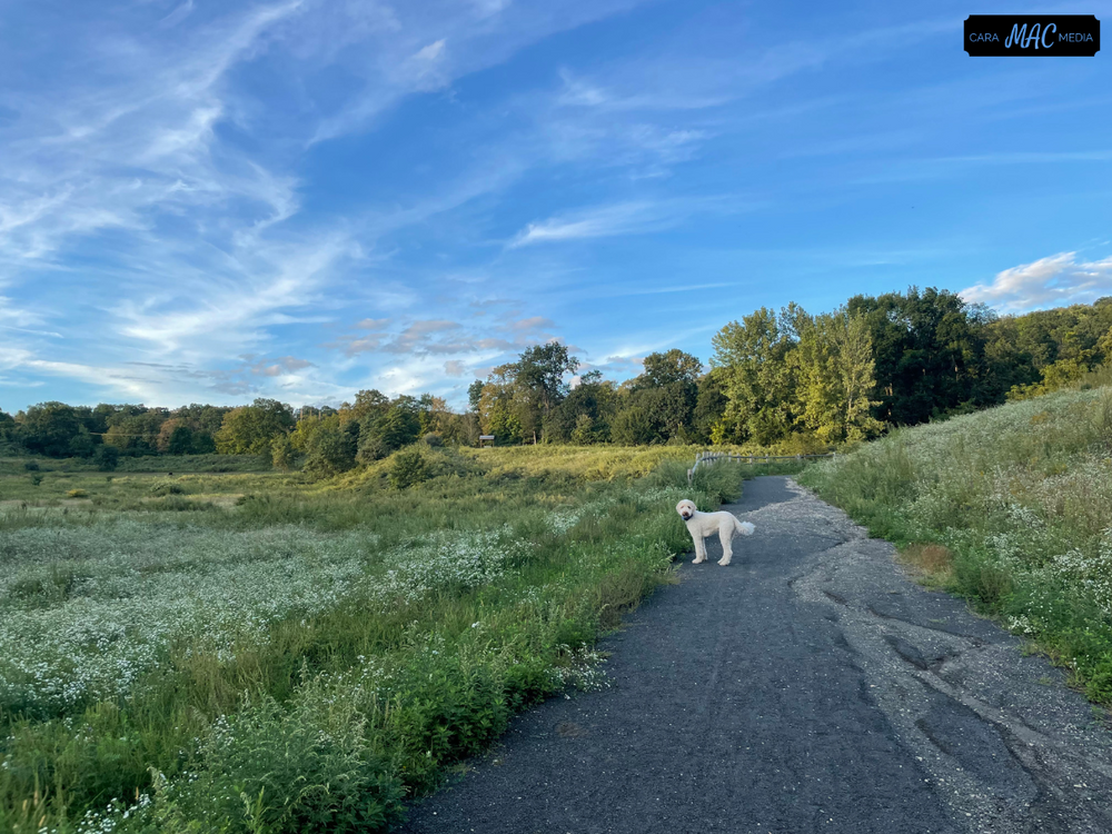
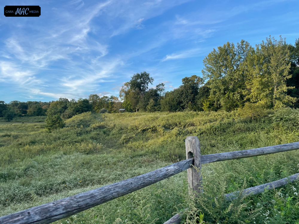
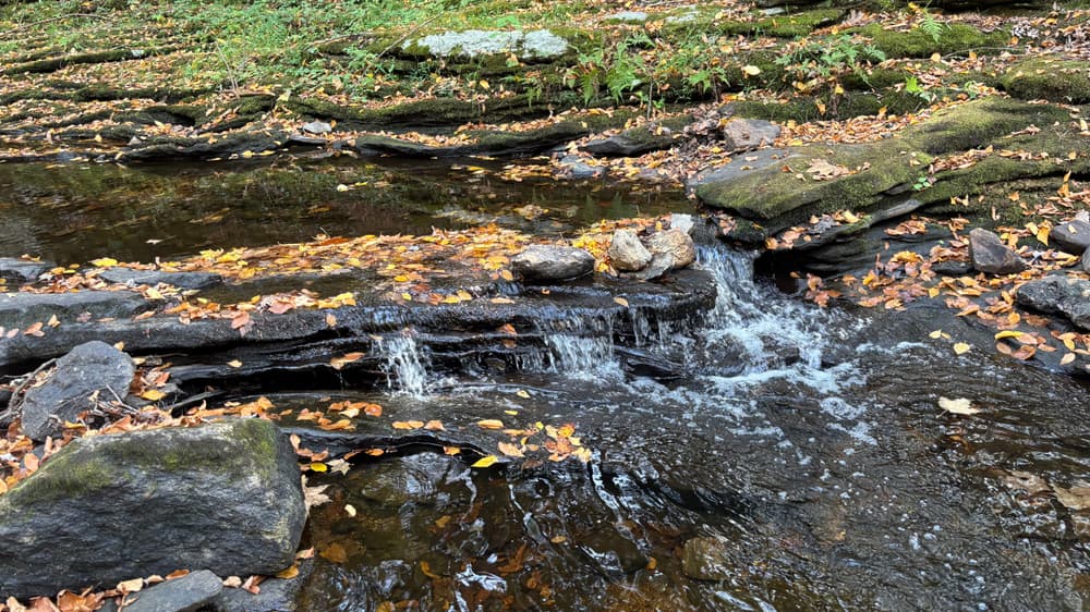
The south section measures approximately 22 miles and, with East Hampton and Hebron being the most utilized. An additional trail spur connects the main trail to the center of Colchester. This section is highlighted by the two tremendous viaducts, but nearly every increment offers locally favorite locations as the trail passes over streams with their requisite stone work, through state forests, past town parks, and along wildlife management areas. Surface conditions vary from compacted earth and crushed rock to gravel and stone dust.
The northern section from Windham to Putnam measures 21 miles with an additional 6.6 miles existing in Thompson. Here the trail has been cut back to its original width, and gravel has been installed from the Massachusetts line south to Sand Dam road, and from the route 12, Mechanicsville parking lot, 1 mile north to the 395 overpass. The rest of the sections in Thompson have been rough graded and work is still in progress. Some sections still have the original rail ballast.
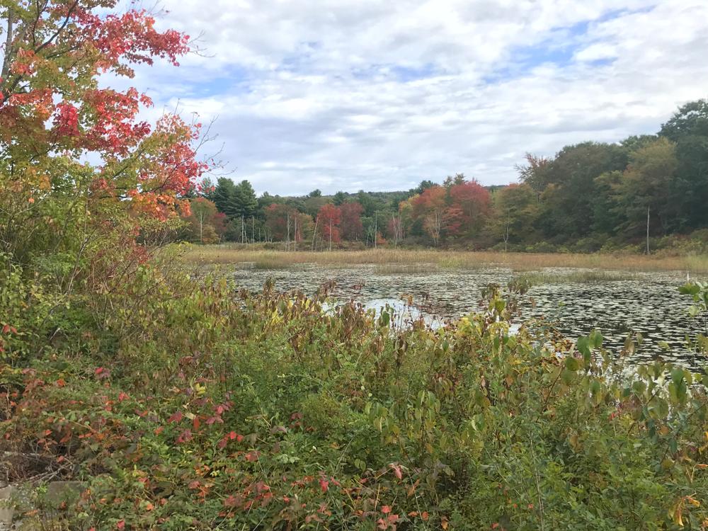
Gravel has been installed in Pomfret, from Pomfret Station located on Railroad Street, south to Covell Road. Work is in progress from Covell Road south to Brooklyn Road. The level section through Goodwin State Forest in Hampton provides a smooth and scenic run, and the southern end of the trail in Windham features a paved surface.
The Air Line State Park Trail has a range of accessibility. The Last Green Valley has completed mobility assessments on segments of trail that can be reviewed through their Explore! Guide. Use the "Search Keyword" function to look up the Air Line State Park Trail, then zoom in and click on the points for section-specific mobility assessments.
The trail takes its name from the imaginary line drawn from New York to Boston, through the “air” so to speak, to illustrate the shortest possible route between these two major east coast cities. Building a completely new rail line however proved economically infeasible so, for practical reasons, the “Air Line” as it came to be called, used existing rails from New York to New Haven and began its journey to the northeast from there. On its way to Boston, the Air Line overcame tremendous obstacles in Connecticut’s eastern highlands including ridges, valleys and of course, politics.
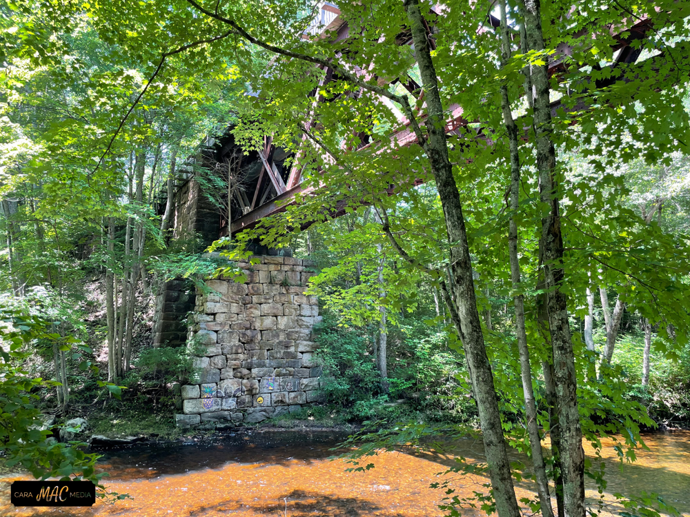
Construction began in the late 1860s and by 1870 the first construction milestone, track from New Haven to Middletown, was celebrated. Three years later, in 1873, the line was completed as far as Windham. This was an especially challenging run because of the landscape which demanded a winding or serpentine rail bed. Despite being limited to the technology of the day, tremendous cuts through the hillsides were accomplished in combination with equally massive “fills” in the valleys to keep the rail bed at grade. Nowhere was this more apparent than at the expansive bridges, or viaducts, over Flat Brook and Dickenson Creek in East Hampton and Colchester respectively. Only 1.2 miles from each other, these stream valleys were first crossed by lengthy bridges. The Rapallo viaduct needed 800 feet of length to cross Flat Brook, and the Lyman Viaduct, just to the east, needed 1,000 feet to span Dickenson Creek.
Further east, another entity laid the rails from Windham to the Connecticut border for the connection with Boston. Here a major obstacle was the crossing of the Quinebaug River in Putnam. But the construction was complete in August of 1872 and, within a year, the reality of the original plan had come to fruition.
Intermittent rail traffic for passengers built up until 1876 when the first dedicated passenger run was scheduled. But it could only be effective if it offered time savings from the pre-existing shoreline route. Slowly, incrementally, time was trimmed from the Air Line travel schedule and by 1885, with an hour savings on the six hour coastal run from New York to Boston, the New England Limited was established. The success of the Limited led to the delivery of new luxury cars by the Pullman Company in 1891. These new cars, white in color and highlighted in gold trim, prompted the railroad to paint the balance of rail cars white and the legendary Ghost Train was born.
Successful businessmen and prominent citizens, including President Benjamin Harrison, rode this increasingly well known line that had gained its name as it sped across Eastern Connecticut with its seemingly luminescent cars being easily recognized - especially at twilight.
As time marched onward to a new century, technology increased, railroad engines became faster, cars became longer and everything became heavier. The quaintness of the Air Line’s winding grades, and the weight restrictions of the spindly trestle bridges built for an earlier era of travel, began to show their limitations. As a result of these limits, traffic began to taper off. Though local runs and intermittent passenger trains continued to run along the line, passenger service of the Ghost Train era concluded on May 17, 1902 when service defaulted to the shore line rails.
Once the faster passenger trains moved to the shore, it was the slower freight trains and local passenger traffic that kept the rail line alive for many years afterwards. In 1912, to accommodate growing weight requirements, the two viaducts were strengthened by filling out their form with 20 months worth of dumped sand, ultimately covered with cinders to stabilize its surface. This work of 100 years ago provided the massive appearance we still see today.
Disastrous flooding of August, 1955 washed out critical bridge work in Putnam precipitating a string of route cancellations and section closures that, in retrospect, systematically crippled the line from ever regaining its usable status. The construction of the interstate highway throughout the 1960s sealed the fate of any future hope of rail bound traffic.
This park is managed by the following CT DEEP Park Headquarters:
Limited parking at 82 Middle Haddam Road.
Limited parking at Smith Street, 0.2 miles from the intersection with Flanders Road.
Take Exit 16 off Route 2 and follow signs to commuter lot which abuts the trail. There is a large parking area and information center on Bull Hill Road about 0.3 miles north of the intersection with River Road. There is also parking on River Road 800 feet south of intersection with South Street.
There is a pull-off for a few cars along River Road 0.4 mile west of the intersection of River Road and Route 149. Pull off for a few cars along Old Hartford Road 0.1 mile east of the intersection with Jones Street.
There is a pull-off for a few cars along Old Colchester Road 300 feet north of Heron Hill Road. There is a large parking area along Church Street (Route 85) 0.5 mile south of the intersection with Route 207. There is also a parking area along Lebanon Road (Route 207) about 0.4 miles east of the intersection with Route 85.
There are a several places to pull-off and park:
There is a pull-off for a few cars at the intersection of Beaver Hill Road and Windham Road (Route 203) in northeast Windham.
There is a large pull off parking area located at the intersection of Chewink and Lynch Roads.
There is a parking area located on Potter Road 0.6 mile north of its intersection with Route 6 in Goodwin State Forest.
There is an 18-car paved parking lot at Pomfret Station, 13 Railroad Avenue (off of Route 169). There is additional parking adjacent to trail on the west side of Pomfret Town Office, 455 Mashamoquet Road (Route 44) as well as in the rear of the Pomfret Senior Center, 207 Mashamoquet Road (Route 44).
There is a large parking lot at 121 Riverside Drive, (Route 12, Mechanicsville) located at the southern end of the Air Line trail in Thompson as well as a pull-off for a few cars at Air Line trail crossing, 388 Sand Dam Road and a small 5-car parking lot located at 662 East Thompson Road, near the junction of New Road.
Success! A new password has been emailed to you.