The 580-acre Fenton Tract is located east of the UConn Storrs campus along the Fenton River and is the largest contiguous parcel of the UConn Forest, which is a multi-use teaching, research, and extension resource managed and coordinated by the Department of Natural Resources and Environment at the University of Connecticut.
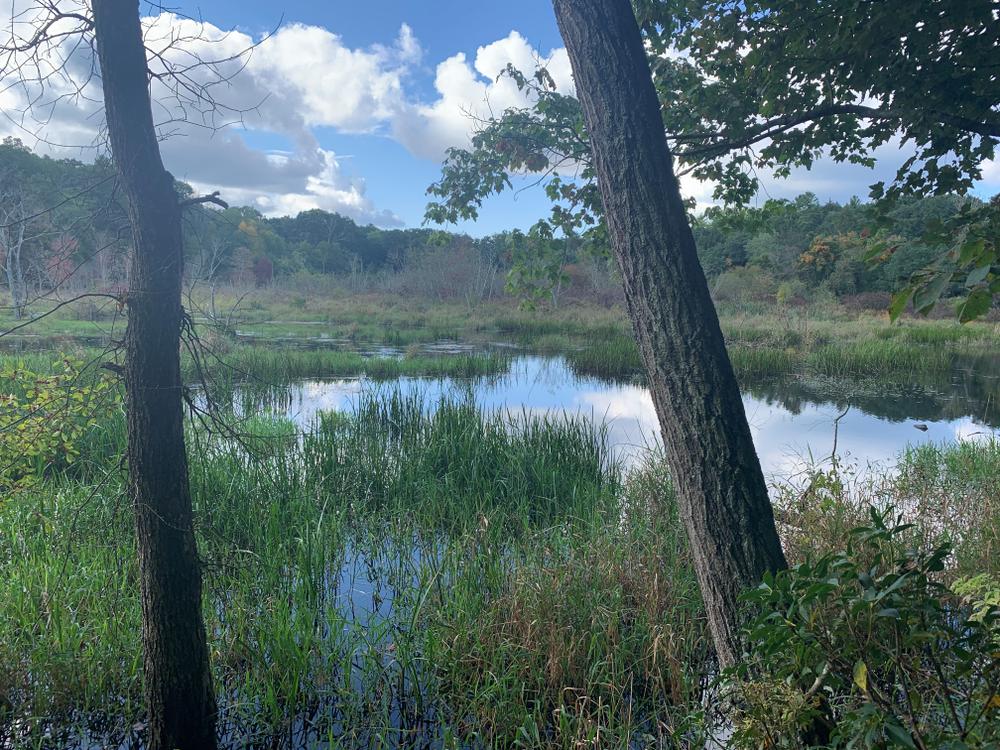
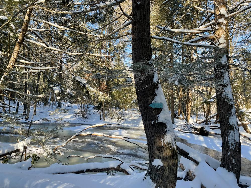
A section of the Blue-Blazed Nipmuck Trail traverses the Tract generally in a north-south direction, with much of it running alongside the scenic Fenton River through hemlock, pine, and oak dominated forests. The trail has some difficult sections and includes a few unbridged stream crossings. Some sections run along or near glacial features such as an extensive snake-like esker system and a pitted kame terrace dominated by very large white pine trees. The northern section follows an old forest road and passes by vernal pools and old gravel quarries. 3.0 miles - Moderate-high difficulty
The Blue-White blazed trail includes a former section of the Nipmuck Trail that runs alongside the Fenton River through old-growth hemlock forests and former spruce plantations. The trail can be difficult to follow in places and has steep, difficult side-hill sections. The trail ends in a large meadow that supports early-successional shrub dominated habitat and has some un-blazed trails that may end in deep mud. This trail is 0.7 miles and moderate-high difficulty.
The northern Green trail connects the picnic area trailhead on Horsebarn Hill to the Nipmuck Trail, it has a difficult crossing of an old concrete dam on an unnamed creek. There is a large section of American beech-dominated forest in the middle section of the trail. This trail is 0.7 miles and moderate difficulty.
The northern Yellow trail connects the agricultural fields on Horsebarn Hill to the Nipmuck Trail, there are wet areas that can be difficult to traverse between the junctions with the White and Green trails. This trail is 0.8 miles and moderate difficulty.
The White blazed trail connects the agricultural fields on Horsebarn Hill to the Yellow trail. It begins at the edge of an open field and winds through mostly hickory-dominated forests. This trail is 0.3 miles and moderate difficulty.
The northern Orange trail connects from Old Turnpike Road (at a location with no trailhead parking) to the Nipmuck Trail along an old forest road through areas with high abundance of invasive shrubs, such as Japanese barberry, associated with the former agricultural use of the land. This trail is 0.5 miles and moderate difficulty.
The Red trail connects the picnic area trailhead on Horsebarn Hill to the Nipmuck Trail. From Horsebarn Hill, the trail initially follows an old forest road then reaches the top of a knoll with a slight view of the Fenton River Valley above steep rock outcrop cliffs. The trail continues off the front side of the knoll down a very steep hill that can be difficult to traverse in slippery conditions. This trail is 0.6 miles and high difficulty.
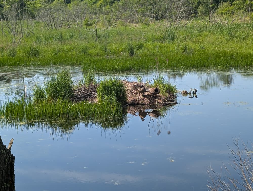
The southern Orange trail connects from an unmarked access point on Gurleyville Road (with no parking) to the Nipmuck Trail near the Beaver Meadow along the Fenton River. The south end of the meadow is generally flooded due to beaver activity and a beaver lodge can be seen in the pond along the trail. From Gurleyville Road the trail follows an old forest road past a defunct concrete block research facility before reaching an active dirt access road that connects the Horsebarn Hill Sciences Complex (no public parking) with UConn Farm Services buildings and the UConn Forest Wood Yard at the top of the powerline corridor. The trail then continues down the hill and coincides with the Yellow and Green trails in different sections. The lower section of the trail can also be accessed on foot from the Pumphouse access road (no unauthorized vehicles). This trail is 1.1 miles and moderate-low difficulty.
The southern Yellow trail follows an historic roadway that connected Storrs and Gurleyville, with very large, open-grown trees growing along the trail and stone walls indicating the former openness of the area. The surface is extremely rocky and uneven and terminates at the Pumphouse access road. This trail is 0.4 miles and moderate-high difficulty.
The southern Green trail connects from the Yellow trail to the Nipmuck trail and largely follows the steep path of the old UConn Ski Hill through early-successional forest that has grown in following the abandonment of the Ski Hill in the 1980's. The trail also passes the UConn Forest Outdoor Classroom, which is used by courses and programs for outdoor-focused education. This trail is 0.5 miles and moderate-high difficulty.
The Fenton Tract contains a wide variety of ecosystems and glacial geomorphological features (eskers, kame terraces, till slopes) and an extensive (~8 miles) network of trails that span the area. The forests are a mix of late-successional hemlock forests along the Fenton River, mid-successional oak-hickory forests on upland slopes, pine forests on glacial-contact landforms, and young, early-successional forests in areas of recent agricultural abandonment.
The Tract includes areas of wetlands including red-maple swamp, open marsh and beaver meadow, and vernal pools. Past land use is readily apparent throughout the Tract including abandoned roadways, foundations, orchards, quarries, research facilities, and a ski hill. Current uses are for education, research, forest management focused on promoting forest health and sustainability, non-timber forest products (e.g., maple syrup production), and low-impact recreation.

From Route 44, take Storrs Road south for one mile. Then turn left onto Horsebarn Hill Road and follow for a quarter mile. Turn right onto Old Farm Lane and then into a gravel parking area on the right. Alternatively, stay on Horsebarn Hill Road for another quarter mile to the roadside parking area on the left.
Take Route 32 North and turn right onto CT-275 East/South Eagleville Road. Follow for 2 miles. Turn right onto Storrs Road and then left onto Hanks Hill Road. Follow for half a mile and turn left onto Farrell Road. In another half mile, turn left onto Bundy Lane and follow for 0.3 miles. Turn right onto Gurleyville Road and into the small roadside parking area. Alternatively, continue on Gurleyville Road for another half mile to two small gravel parking lots on the left near the Nipmuck Trail.
Success! A new password has been emailed to you.