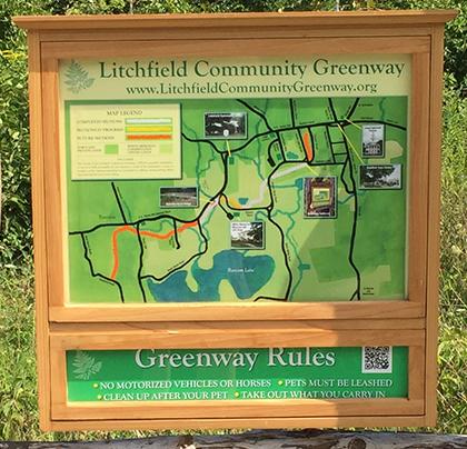
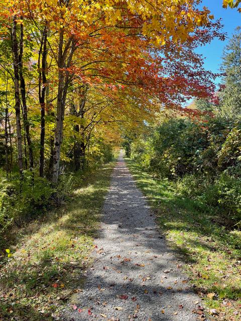
Over 1000 miles of trail available to explore, and more added each day!

Litchfield Community Greenway

The Litchfield Community Greenway is a flat, multi-use gravel trail that runs along the former Shepaug Railroad path through a collection of natural habitats, wetlands preserves, and conservation land. The two mile trail is perfect for all ages. Join Us!
Trail Activity
Accessible Experience Hiking Walking Bicycling Cross-country skiing Mountain biking
Length
2.1 miles, One Way
Difficulty
Easy
Town
Litchfield
Surface
Packed Earth/Dirt, Gravel/Crushed Stone, Boardwalk
Pets
Permitted on leash
Fees
No

Description

Since 2004, a group of committed volunteers has been hard at work to bring the Litchfield Community Greenway from a dream to reality. Through perseverance, a small group of dedicated community members have since created a trail that is now more than two miles long along the former rail bed of the Shepaug Railway. While the first few sections took a while, we’ve really gained steam and are looking forward to substantial expansions in 2024.

Phase I, South Lake Street to White Woods Road

The initial section starts at the corner of South Lake Street which is the northern end of the trail. It includes the Ghost Trail, the hallmark foundation that was completed in 2010 along the former rail bed.

Phase II, White Woods Road to Bissell Road

Phase II of the trail continues south into White Memorial Conservation Center, winding through the beautiful wetlands and forest, and ultimately terminating at Bissell Road. A new parking area was built on White Woods Road in 2022 providing ample Greenway parking.
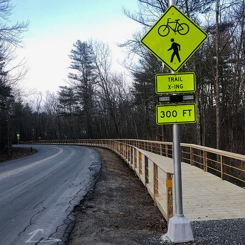
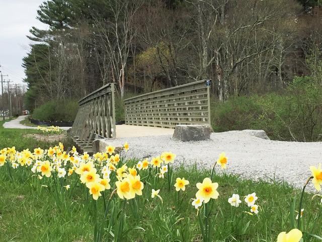
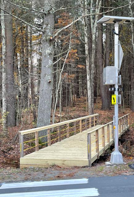
Phase III, Bissell Road to North Shore Road

Phase III now connects the south end of Phase II via a 300 foot boardwalk that follows and crosses Bissell Road before reconnecting with the former railway bed along Route 202. This sections includes the "Bridge to Everywhere" which crosses Butternut Brook where some additional benches, parking, and wonderful daffodils can be found. This flat trail then continues south behind the Litchfield Distillery and terminates at North Shore Road where additional benches and parking is available.

Looking Ahead

The Greenway will soon extend towards the center of Litchfield along Russell Street, including new parking and a new trailhead at the original Shepaug Railway station, which will serve as the Greenway headquarters. Beyond that, the Greenway anticipates extending west by an additional 1.9 miles and eventually terminating at Stoddard Road, nearly at the border of Morris. In the future, the Friends of the Litchfield Community Greenway hope that the Greenway will connect to the extensive trail systems in Washington and Roxbury.

Other Information

As a non-profit 501c3 organization, The Friends of the Litchfield Community Greenway is an all-volunteer organization overseeing the development of the Greenway. We are thankful to all of our supporters and look forward to our continued progress to support the community. Join us!

Trail Manager

Friends of the Litchfield Community Greenway
P.O. Box 778
28C Russell Street
Litchfield, CT 06759
View website

Trail Tips

Plan Ahead and Prepare
Be prepared to find your way home. Familiarize yourself with the area before you set out and bring your map and compass along.
Legend
Hide All

Trailhead Information

Current start - Corner of White Woods Road, South Lake Street & Russell Street
Alternate Entrance - White Woods Road with new dedicated parking
Alternate Entrance - Little Pond Trailhead - new parking available on White Woods Road
Alternate Entrance - Butternut Brook bridge - Route 202 - trail parking available
Alternate Entrance - Bissell Road Boardwalk
Current End - North Shore Road - trail parking available

Click on a parking icon to get custom directions
Please Log In or Create Account to add comments.
SHARE THIS TRAIL
PRINT THIS TRAIL

Add Trail Log

Please wait…
Join In on the Fun!
Log in or create an account below to unlock all the great features of Connecticut Trail Finder: keep track of trails you want to do, preserve memories of trails you’ve done, and more!
Your log in attempt was not successful. Please try again.
    Lost your password? Reset your password
    Don't yet have an account?
    There was an issue with your submission. Please try again.
      * Indicates required field
      Already have an account? Login here
      Enter your username, and we will send you a new, randomly generated password to your email account.
      There was an issue with your submission. Please try again.

        Success! A new password has been emailed to you.

        Log in now

        Please wait…