Hunting Season:Review CT DEEP's outdoor safety tips to stay safe on the trails!

Macricostas Preserve

Macricostas Preserve offers a variety of popular hiking trails over swamp bridges and boardwalks, fields, and summits with awe-inspiring vistas, wildlife viewing opportunities, and a community garden.
Trail Activity
Hiking Cross-country skiing
Length
7.2 miles, Network
Difficulty
Easy, Moderate, Advanced
Town
Washington
Surface
Packed Earth/Dirt, Gravel/Crushed Stone, Rock/Ledge, Grass, Boardwalk
Pets
Permitted on leash
Fees
No

Description

The over 630-acre Macricostas Preserve is the most ecologically rich among the Steep Rock Association network of nature preserves. The diverse habitats include a rocky ridgeline situated above prime farmland, Bee Brook, and Meeker Swamp.

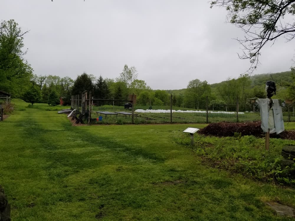
Near the parking area is the StoryWalk Trail, a community collaboration between Steep Rock Association, Gunn Memorial Library, and Washington Supply. Pages from nature-focused children's books are posted on display boards and are changed seasonally. The trail begins in Judea Garden, a community-led garden operating since 2009 as a place for local volunteers to provide fresh produce to their neighbors during difficult economic times.

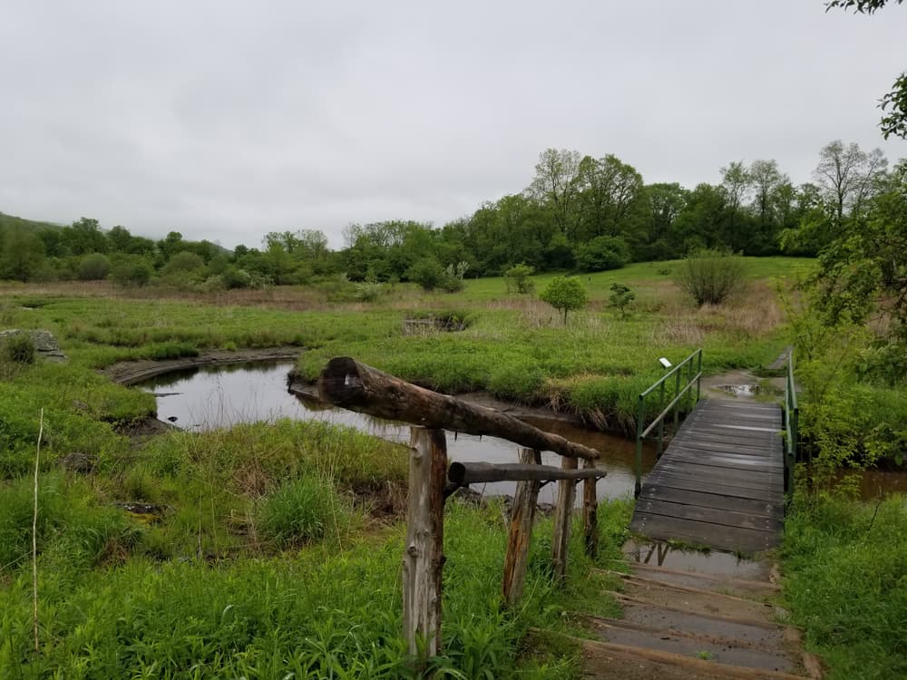
The Meeker Trail and Hay Field Loop provide views of Meeker Swamp, the adjacent hayfield, and the myriad of songbirds, butterflies, and other wildlife that live there. Meeker Swamp is a unique calcareous wetland – a chalky limestone-based geology rarely found east of the Appalachian Mountains. One of the last significant calcareous ecosystems in the Northeast Hills, it encompasses over 300 acres and includes part of the Bee Brook stream, wet meadows and agricultural fields as well as an adjacent ridge of talus slopes and rocky outcroppings. An excellent habitat for a variety of wildlife, the preserve overlies one of Washington’s largest aquifers and protects the town’s drinking water supply.

Views from the Ridgeline Trail and Macricostas Overlook on the Meeker Trail are of the swamp and hayfield from above as well as of neighboring Hidden Valley Preserve.

On Waramaug's Trail, Waramaug’s Rock is an overlook with panoramic views of the countryside including Lake Waramaug. Lake Waramaug is the second largest natural lake in Connecticut, named after a chief of the Wyantenock Indian tribe. It provides ecologically vital habitat for wildlife and a recreational center for the Towns of Washington, Warren and Kent. The views from the top are a rewarding dividend for the steep hike there.

Other Information

History

About a third of this acreage (238) was purchased and preserved in 2000 through a collaborative partnership, with funding provided by the State of Connecticut, the Town of Washington, and the generosity of individual donors.

Rules

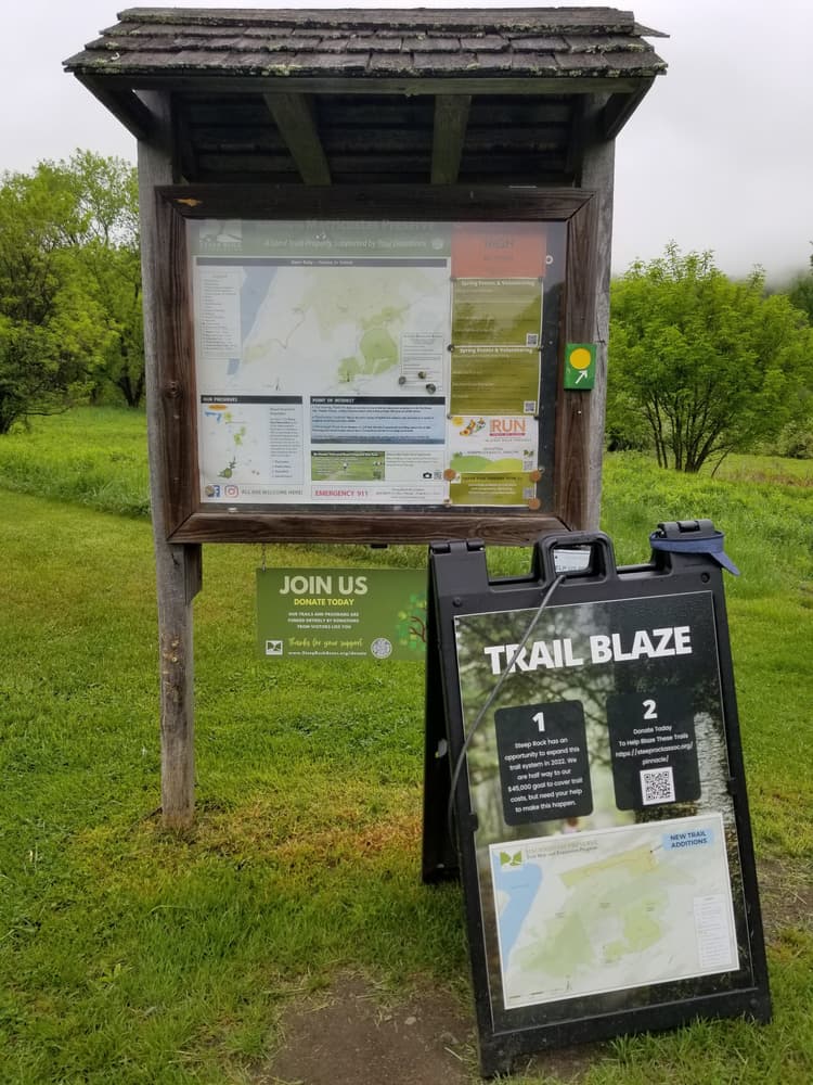
The preserve is open daily from sunrise to sunset.

Please adhere to the following regulations when visiting.

  • Leave No Trace. Do not litter: please carry out what you carry in.
  • Permits are required for collecting and foraging.
  • Do not remove or destroy plants, animals, rocks, minerals or other natural objects, and do not approach or disturb wildlife.
  • Please park only in designated areas.
  • Camping, hunting, fires, drones, and alcoholic beverages are prohibited.
  • Trails are foot travel only: no bikes, e-bikes, motorbikes, or horseback riding.
  • Motorized vehicles are prohibited. Use of Other Power-Driven Mobility Devices is restricted. For
    approval, contact the SRA Office at (860) 868-9131.
  • Please avoid making loud noise, including music.
  • Dogs are welcome on leash only.
  • Do not harm trees by chopping, carving or driving nails.
  • Do not litter: please carry out what you carry in.
  • Permits are required for groups of 15 or more and for commercial activities.

In winter

  • Cross-Country Skiers: Please set tracks on one side of the trail only.
  • Hikers, Snowshoers and Dog-owners: please respect ski tracts by keeping to the other side of the trail.

Trail Manager

Steep Rock Association
P.O. Box 279
Washington Depot, Connecticut 06794-0279
(860) 868-9131
View website

Trail Tips

Plan Ahead and Prepare
Tell someone your plan and when you’ll return, just in case.
Legend
Hide All

Trailhead Information

From Torrington

Follow US-202 West for 15 miles. Then turn right onto Christian Street. In 0.2 miles, turn right into the parking area at Judea Garden.

From Danbury

Follow I-84 East to Exit 7. Take Exit 7 for US-7 East toward US-202/Brookfield/New Milford. Continue onto US-202 East/US-7 North and follow for 6 miles. Continue to follow US-202 East for 14.6 miles. Then turn left onto Christian Street. In half a mile, turn left into the parking area at Judea Garden.

Click on a parking icon to get custom directions
Please Log In or Create Account to add comments.
Add a Service
Find businesses and organizations that are located around this trail that support adventuring outdoors!
Legend
Hide All
Hide All
No services shown. Try zooming out.
Hang Tight!
Nearby services are loading
SHARE THIS TRAIL
PRINT THIS TRAIL

Add Trail Log

Please wait…
Join In on the Fun!
Log in or create an account below to unlock all the great features of Connecticut Trail Finder: keep track of trails you want to do, preserve memories of trails you’ve done, and more!
Your log in attempt was not successful. Please try again.
    Lost your password? Reset your password
    Don't yet have an account?
    There was an issue with your submission. Please try again.
      * Indicates required field
      Already have an account? Login here
      Enter your username, and we will send you a new, randomly generated password to your email account.
      There was an issue with your submission. Please try again.

        Success! A new password has been emailed to you.

        Log in now

        Please wait…