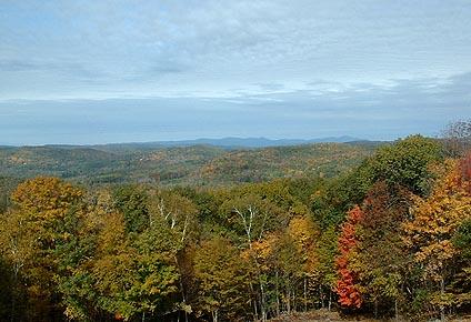
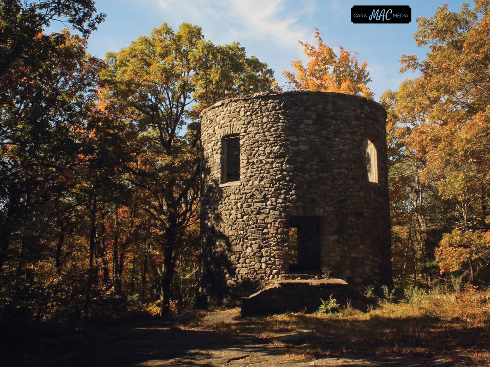
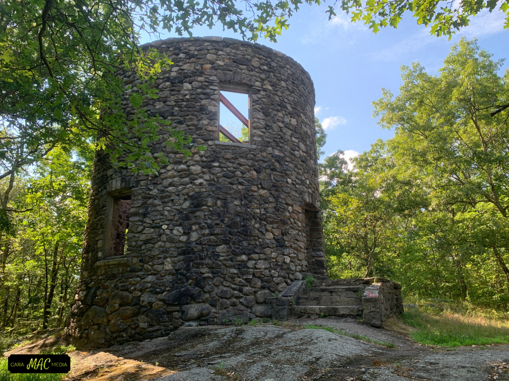
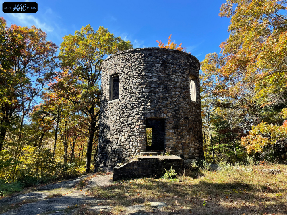
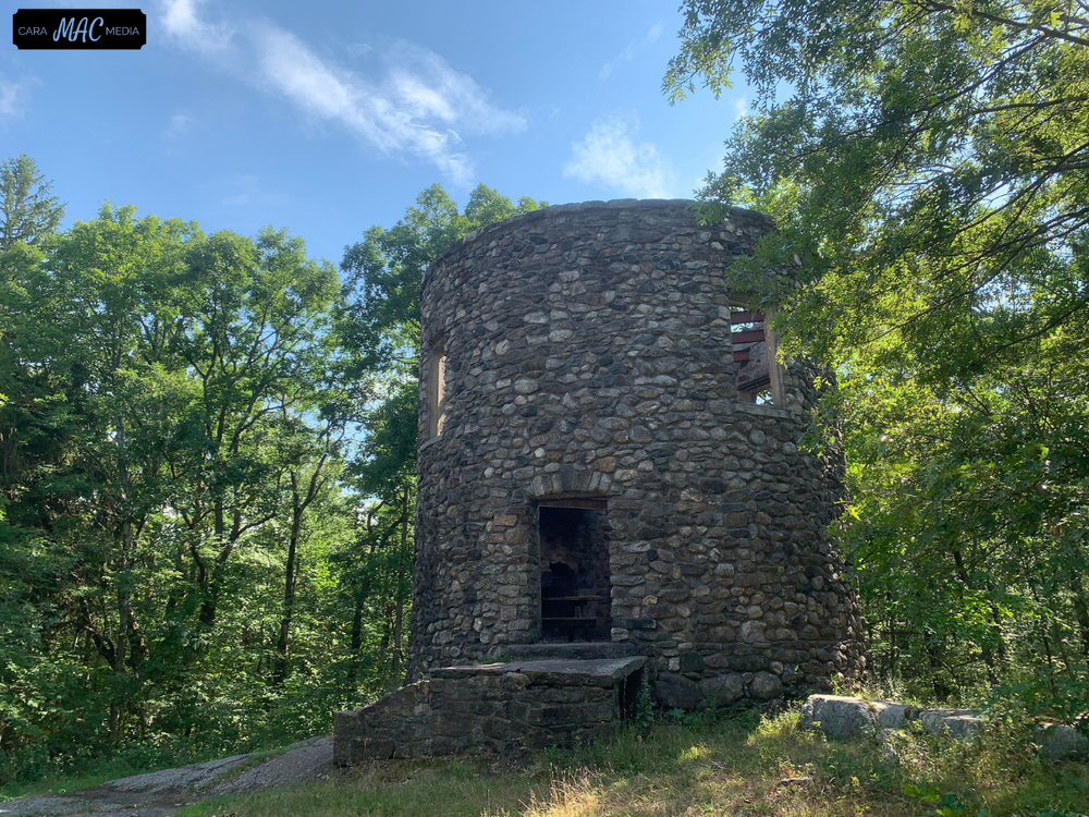
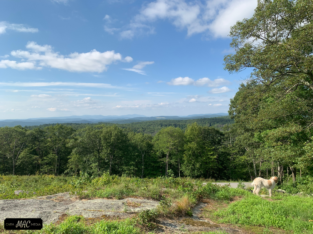
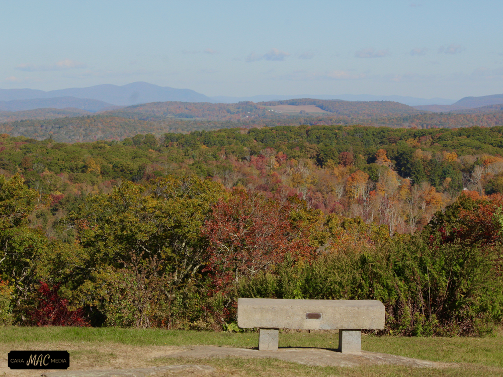
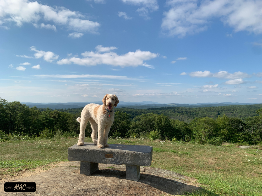
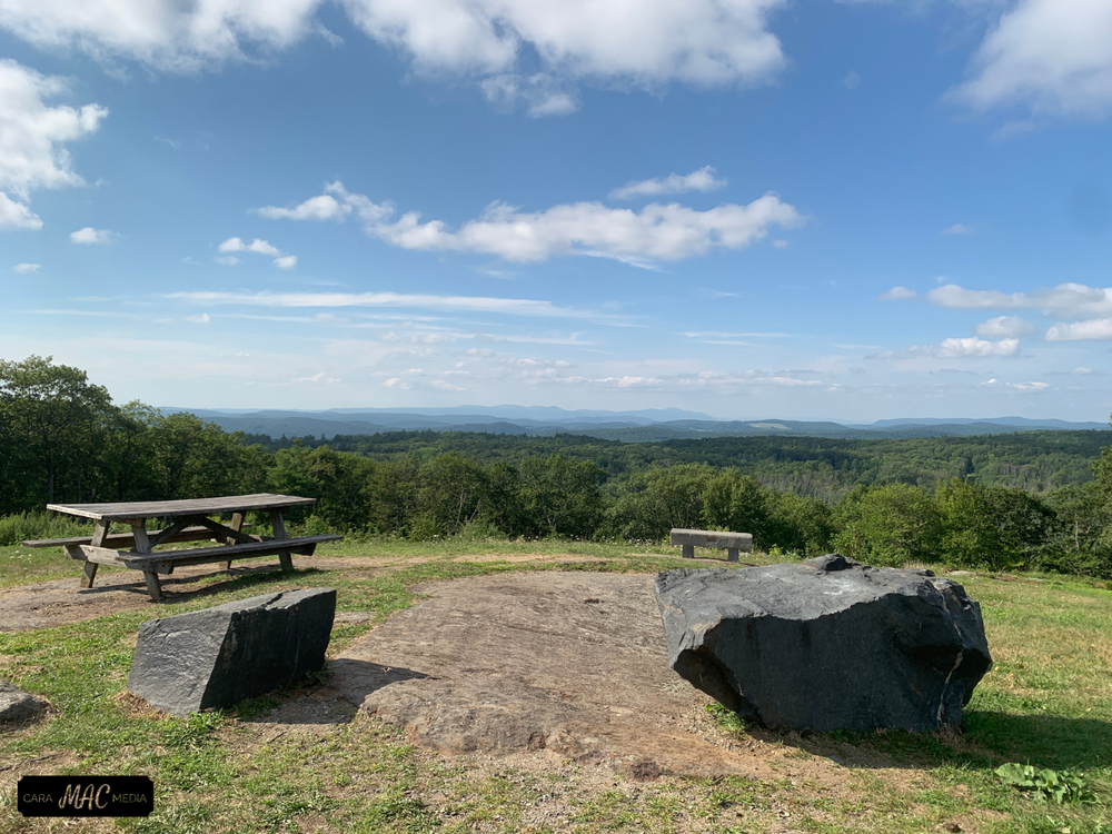
Several hilltop towers made of wood and stone have succumbed to time and exposure to the elements. Each structure has served to detect forest fires, including the present tower, which was erected by the American Telephone and Telegraph Company to relay radio signals. There is also a tower that is used for radio transmissions by the State Police and the D.E.P. for public safety. Scenic vistas to the north and west include the Catskill, Taconic and Berkshire ranges.
The Black Spruce Bog is located near the Forest Headquarters. The area was probably formed as a “sink hole” after the last glacial period, by the melting of a large block of ice that left a depression about 40 feet deep which filled with water. Gradually plant growth filled the area from the edges toward the center.
The site has long been recognized as a unique natural area and represents one of the few such plant communities of its type in Connecticut. It is also noteworthy that within the bog, individual specimens of Black Spruce and Larch have achieved a stature rarely found in the state. As this plant community is considered an outstanding example of a late-stage peat bog, it is a popular site for educational activities and scientific purposes and features a trail and boardwalk placed to minimize damage to the bog.
A section of the Mohawk Trail provides hikers with interesting views and an occasional glimpse of deer, fox or bobcat. Both stream and pond fishing are popular within the forest. Multiple use of trails includes over ten miles devoted to snowmobiles when the snow depth is 6 inches or more.
The Mohawk Ski Area offers winter outdoorsmen a choice of tows and lifts leading to a variety of wooded and open downhill runs. Provision for making snow is available when nature fails to provide sufficient quantities.
Colonial historians note the use of the high promontory by the Tunxis and Paugussett Indians who used smoke signals to warn local tribes of the approach of the dreaded Mohawks from the north and west. Although tribal wars terminated centuries ago, the name “Mohawk Mountain” has carried forward.
Public use of the ledgy, wooded hills began in 1921, with the gift to Connecticut citizens of 250 acres by Alain C. White. In total, the White Memorial Foundation contributed over 2,900 acres to the acquisition of the forest. The holding has since grown to include over 3,300 acres in the towns of Cornwall and Goshen. By deed restriction, the forest is a game preserve and no firearms are allowed. In the 1930’s the Civilian Conservation Corps. established Camp Toumey, located near what is now the Forest Headquarters. Remnants of buildings and fireplace chimneys can be found in this area.
Video Tour of Mohawk Mountain State Forest/Park (link to ‘The Outdoor Enthusiast’ - CT Public Broadcastings’ Media Lab online project)
This park is managed by the following CT DEEP Park Headquarters:

Take Route 8 north to Exit 42, (Harwinton). Proceed west on Route 118 to the center of Litchfield, and then head north on Route 63 to the rotary in Goshen Center. Take Route 4 west from Goshen approximately 4 miles to the entrance on the left for Mohawk State Forest.
Take Route 7 south onto Route 63 south to the rotary in Goshen, then Route 4 west to Mohawk State Forest.
Success! A new password has been emailed to you.