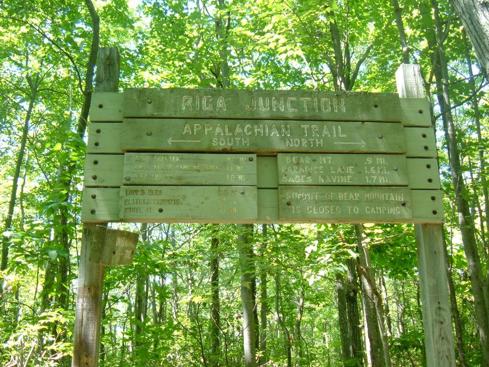
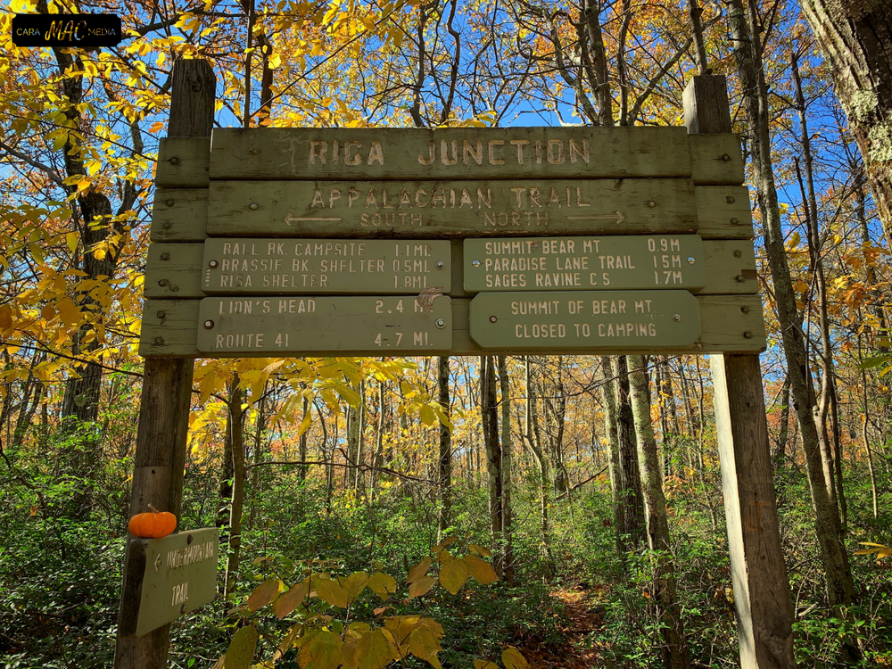
Over 1000 miles of trail available to explore, and more added each day!

Mount Riga State Park and Bear Mountain Loop

Mount Riga State Park contains a portion of the Undermountain Trail, which connects to both Paradise Land Trail and the Appalachian Trail, forming a popular 5 mile loop that includes Bear Mountain, the tallest point in Connecticut.  
Trail Activity
Hiking Walking
Length
5.4 miles, Loop
Difficulty
Moderate, Advanced
Surface
Packed Earth/Dirt, Rock/Ledge
Pets
Permitted
Fees
No

Description

Mount Riga State Park is a 276 acre park that contains the trailhead and 0.6 miles of the Undermountain Trail (1.8 miles long in total) which connects to the popular Paradise Lane Trail and Appalachian Trail. 
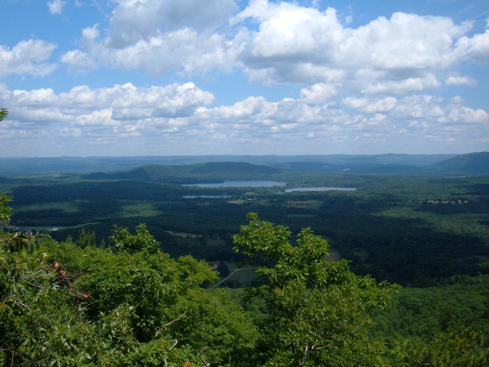
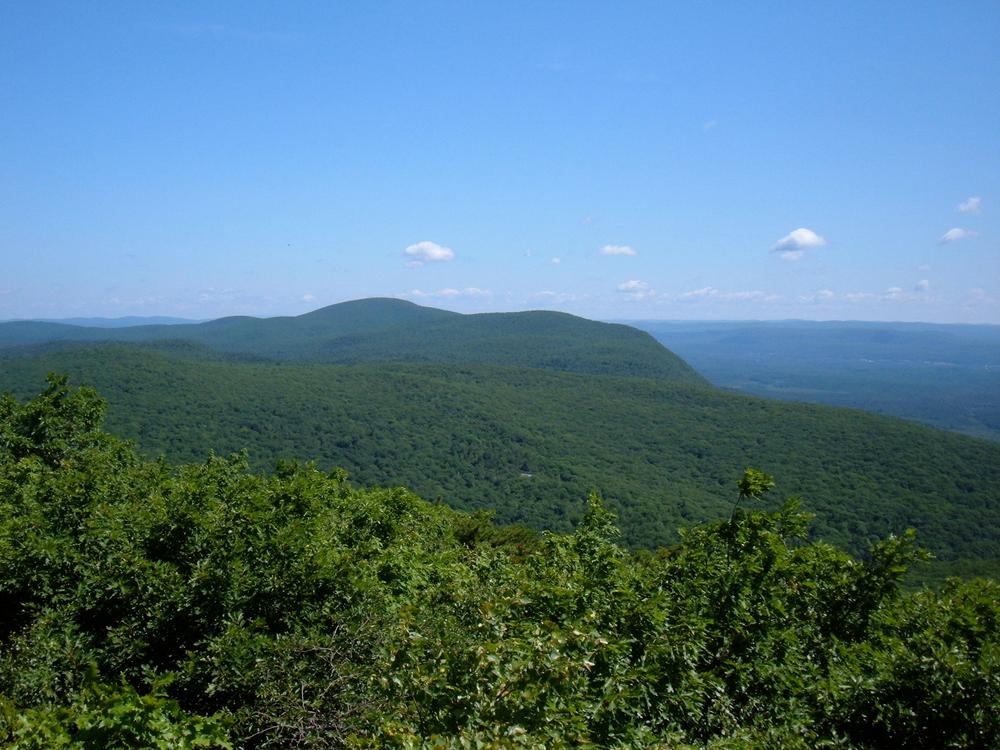
Hikers can reach the Appalachian Trail directly from Undermountain Trail, or can complete a 5 mile loop that includes Bear Mountain, the tallest mountain in Connecticut and has great views of New York, Massachusetts, and Connecticut, a small portion in Massachusetts, and returns via Paradise Lane Trail.  

The majority of Mount Riga State Park is north of the Undermountain Trail and is undeveloped. 

Other Information

The Undermountain Trail begins at the parking area and continues west through Mount Riga State Park.  

Archery hunting (deer and turkey only) is permitted in Mount Riga State Park. Please be aware of postings. 

Trail Manager

CT DEEP: Macedonia Brook State Park
159 Macedonia Brook Road
Kent, CT 06757
(860) 927-3238
View website
Connecticut Chapter of the Appalachian Mountain Club
-
-
View website

Trail Tips

Plan Ahead and Prepare
Be prepared for extreme weather. Bring rain/wind gear, warm clothing, and matches/fire starters.
Legend
Hide All

Trailhead Information

From the junction of Route 44 and Route 41 in the center of Salisbury, proceed north on Route 41 3.2 miles to the Undermountain Trail parking area on the left.

Click on a parking icon to get custom directions
Please Log In or Create Account to add comments.
SHARE THIS TRAIL
PRINT THIS TRAIL

Add Trail Log

Please wait…
Join In on the Fun!
Log in or create an account below to unlock all the great features of Connecticut Trail Finder: keep track of trails you want to do, preserve memories of trails you’ve done, and more!
Your log in attempt was not successful. Please try again.
    Lost your password? Reset your password
    Don't yet have an account?
    There was an issue with your submission. Please try again.
      * Indicates required field
      Already have an account? Login here
      Enter your username, and we will send you a new, randomly generated password to your email account.
      There was an issue with your submission. Please try again.

        Success! A new password has been emailed to you.

        Log in now

        Please wait…