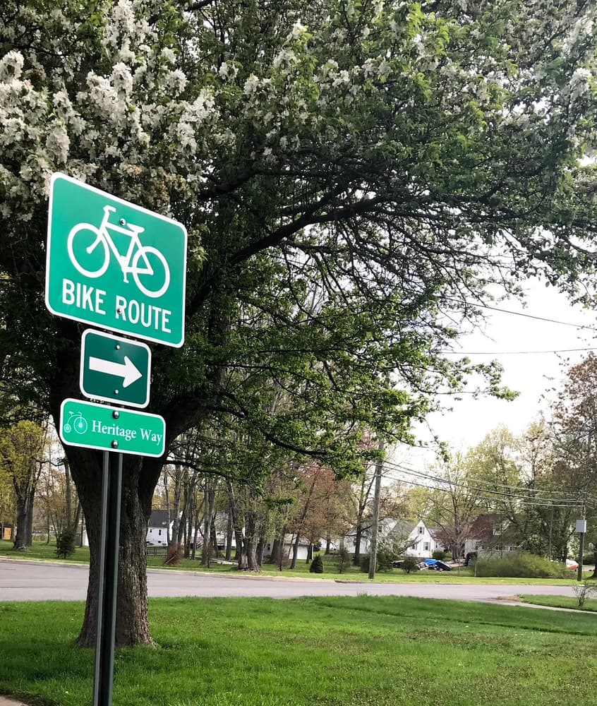
The Wethersfield Heritage Way, recognized as a Connecticut Greenway in 2021, is a cross-town bicycling and walking route that connects and explores a wealth of recreational, historical, agricultural, open space and natural assets in one of Connecticut's oldest towns. This multi-use path primarily consists of on-road sections on existing roadways with safety signage, but it also features off-road portions on town-owned land and crushed stone surfaces.
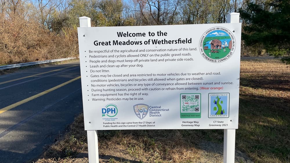
The Heritage Way Bike Route begins at the 1860 Reservoir in the southwestern corner of the town, traveling past farmlands and the historic village of Griswoldville. It then continues through town parks, wooded trails and school yards, across a rail corridor to the Wethersfield Cove. From there, the route runs along town streets through the heart of Old Wethersfield, the largest Historic District in the State. Leaving the historic center, riders can access the Putnam Bridge Bike Path to cross the Connecticut River, or continue through the floodplain and farms of the Great Meadows along the west bank of the river. Starting at the 1860 Reservoir and ending in Great Meadows at the Rocky Hill Town Line, this bike route is 9.9 miles long. Beyond, the Heritage Way Bike Route connects directly with the Great Meadows Greenway in Rocky Hill which continues all the way to the Rocky Hill-Glastonbury Ferry.
The Loop to Broad Street Green follows Main Street, then Garden Street, then Broad Street around the Green and back. The loop around the Green parallels the Wethersfield Heritage Walk. Starting at the intersection of Main Street and Hart Street, looping around the Green and back is 2.2 miles.
The Church Street Bike Route between Folly Brook Trail and Main Street is 1.2 miles long, with a bike repair station along the way.
Hybrid bikes are suggested as portions of the route are crushed stone or packed dirt.
Use caution when crossing roadways. Pedestrians should cross at marked crosswalks when possible.
Connecticut's helmet law requires children under the age of sixteen to wear bicycle helmets.
The Wethersfield Police provide excellent information about bicycle safety and laws in Wethersfield.
From I-91, take Exit 24 for Wethersfield/Rocky Hill/Route 99 and head north towards Wethersfield. Turn left onto Town Line Road and left again onto Charter Road. Turn right onto Waters Avenue and then left again onto Maple Street/Route 3 south. Turn right onto Fox Hill Road and follow Fox Hill Road which turns into Old Common Road for 1.3 miles. Turn right onto Highland Street, and the dirt road to the 1860 Reservoir will be on the left.
From Route 5, take Prospect Street east and then turn right/south onto Thornbush Road. Shortly after Thornbush Road meets Highland Street, the dirt road to the 1860 Reservoir will be on the right.
From I-91 N, take Exits 25-26, then stay to the right and take Exit 26 towards Old Wethersfield. After 0.5 miles, turn left onto Great Meadow Road and the parking lot will be on the right.
From I-91 S, take Exit 26 towards Old Wethersfield. Turn left onto Great Meadow Road and cross underneath I-91. Turn right to stay on Great Meadow Road and cross underneath Route 3. Just past the underpass, the parking lot is on the left.
Success! A new password has been emailed to you.