New Feature:Now earn badges with a free CT Trail Finder account!

Willimantic River Water Trail

The Willimantic River Water Trail provides more than 22 miles of paddling enjoyment and challenges between Stafford Springs and Windham, Connecticut, with only one short portage. 
Trail Activity
Paddling
Length
23.1 miles, One Way
Difficulty
Easy, Moderate, Advanced
Towns
Stafford, Ellington, Tolland, Willington, Coventry, Mansfield, Windham
Surface
River/Stream, Lake/Pond
Pets
Unknown
Fees
No

Description

The Willimantic River Water Trail, like the Shetucket River and the Quinebaug River Water Trails, has been recognized as a National Recreation Trail by the Secretary of Interior for being “exemplary trails of local and regional significance.” They are part of The Last Green Valley National Heritage Corridor.

There are three major segments of the Willimantic River Water Trail

  1. rapids and quickwater of the narrow upper section,
  2. flatwater impoundment above Eagleville Lake Dam, and
  3. moderate current and flatwater down to Willimantic.

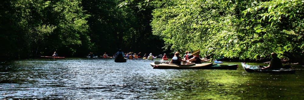
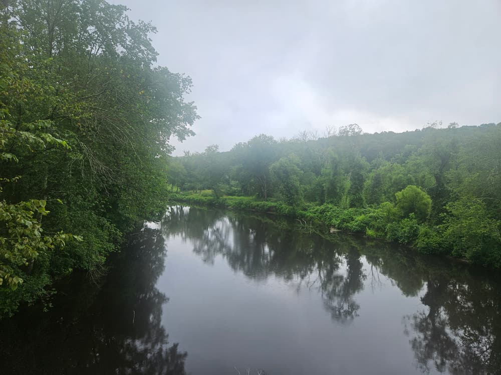
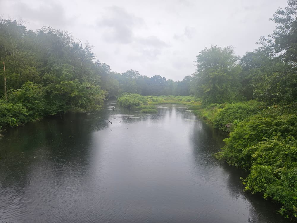
Like all streams and rivers, the Willimantic changes character every day, even hourly. Ultimately, it’s up to you to make good choices based on the weather, the river, paddling expertise, and equipment. Before heading out, check the weather as well as USGS online stream gauges. Please consult The Last Green Valley's Paddle Guide for more details on launch sites and paddling sections.

Other Information

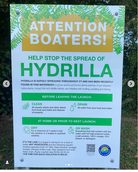
To help protect this water trail:

  • Carry out everything you carry in. Take an extra grocery bag to stash trash you find along the way. Make every day a clean-up day.
  • Avoid eroding the launch and landing sites.
  • Contact The Last Green Valley or the Willimantic Whitewater Partnership for outings and volunteer opportunities.

Trail Manager

The Last Green Valley, Inc.
203B Main Street
P.O. Box 29
Danielson, CT 06239-0029
(860) 774-3300
View website

Trail Tips

Plan Ahead and Prepare
Be prepared for extreme weather. Bring rain/wind gear, warm clothing, and matches/fire starters.
Legend
Hide All

Trailhead Information

Northern Trailhead: Stafford Springs Commuter Lot

From the lot there is a flat, 25 feet carry to the river. The put-in is easy and almost level, but once in the boat, there is current right away.

From I-84, take Exit 70 and head north on Route 32/River Road. After 8.5 miles, just before the Stafford Water Pollution Facility, the Commuter Lot and river access will be on your right. There is parking for about 15 cars for paddlers during weekends only. 

From Stafford Springs and points north, take Route 32/River Road south towards I-84 and Willington. Just past the Water Pollution Facility, Commuter Lot and river access will be on your left. There is parking for about 15 cars for paddlers during weekends only. 

Southern trailhead: access road to the CT Eastern Railroad Museum, Willimantic

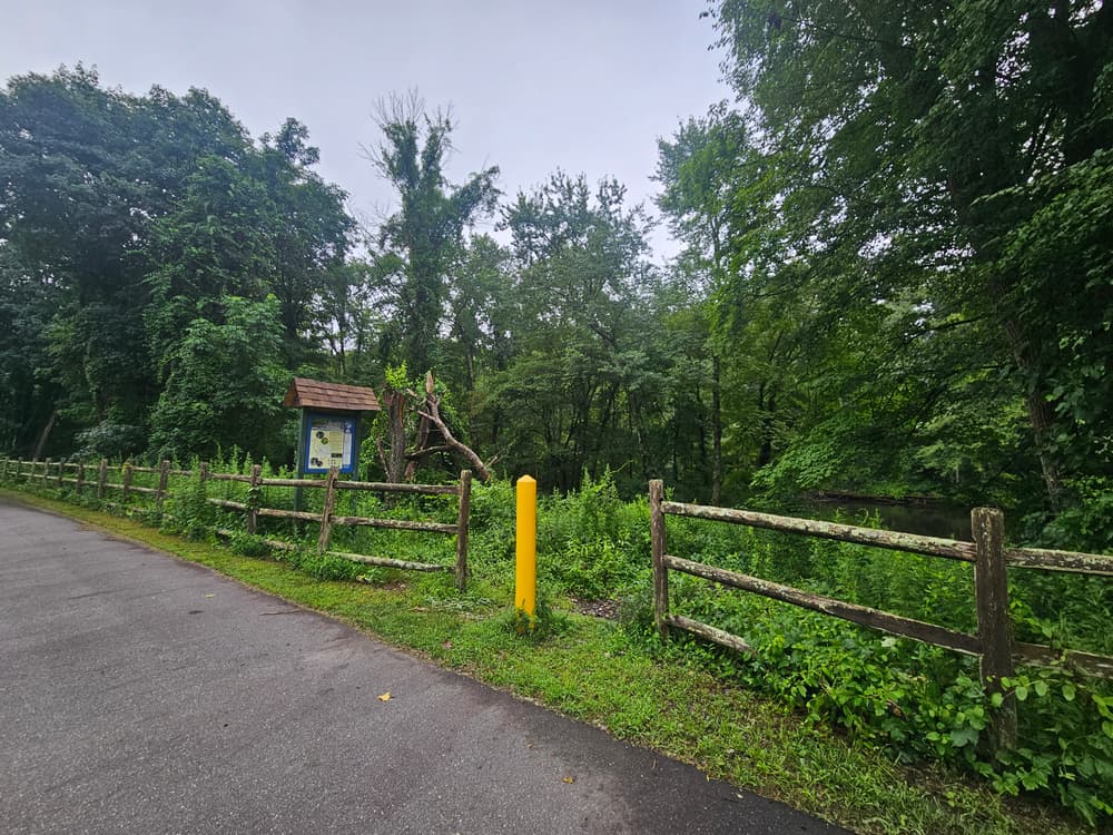
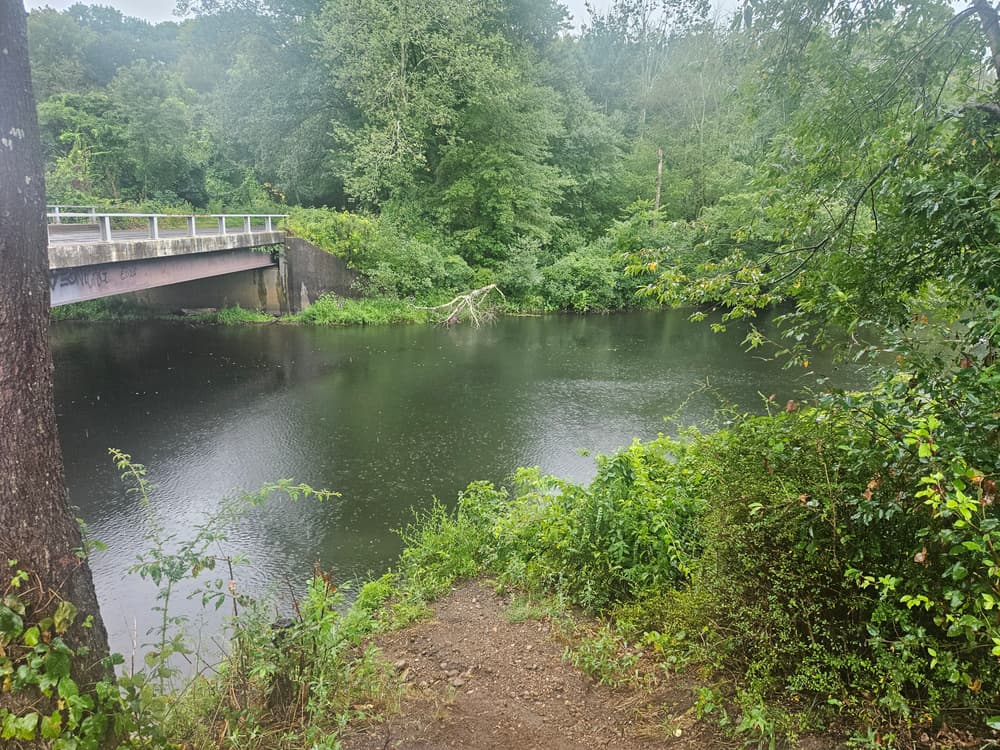
From Main Street (Route 66) in downtown Willimantic, take Bridge Street south, cross over the railroad tracks and take an immediate right at the sign for the Connecticut Eastern Railroad Museum. The dirt road follows the newly paved Air Line Trail and after 0.5 miles, the launch and landing site on the left. Look for the Willimantic River Information kiosk. It is a short carry down a newly constructed path to the water. The landing at the Air Line Trail in Willimantic is the last landing area on the Willimantic River. It is also a good location to launch for a leisurely paddle upstream. 

For all other launch/landing sites, click on the parking icons on the map and consult The Last Green Valley's Paddle Guide for more details.

Click on a parking icon to get custom directions
Please Log In or Create Account to add comments.
Add a Service
Find businesses and organizations that are located around this trail that support adventuring outdoors!
Legend
Hide All
Hide All
No services shown. Try zooming out.
Hang Tight!
Nearby services are loading
SHARE THIS TRAIL
PRINT THIS TRAIL

Add Trail Log

Please wait…
Join In on the Fun!
Log in or create an account below to unlock all the great features of Connecticut Trail Finder: keep track of trails you want to do, preserve memories of trails you’ve done, and more!
Your log in attempt was not successful. Please try again.
    Lost your password? Reset your password
    Don't yet have an account?
    There was an issue with your submission. Please try again.
      * Indicates required field
      Already have an account? Login here
      Enter your username, and we will send you a new, randomly generated password to your email account.
      There was an issue with your submission. Please try again.

        Success! A new password has been emailed to you.

        Log in now

        Please wait…